1-minute imagery to monitor convection across the Samoan Islands
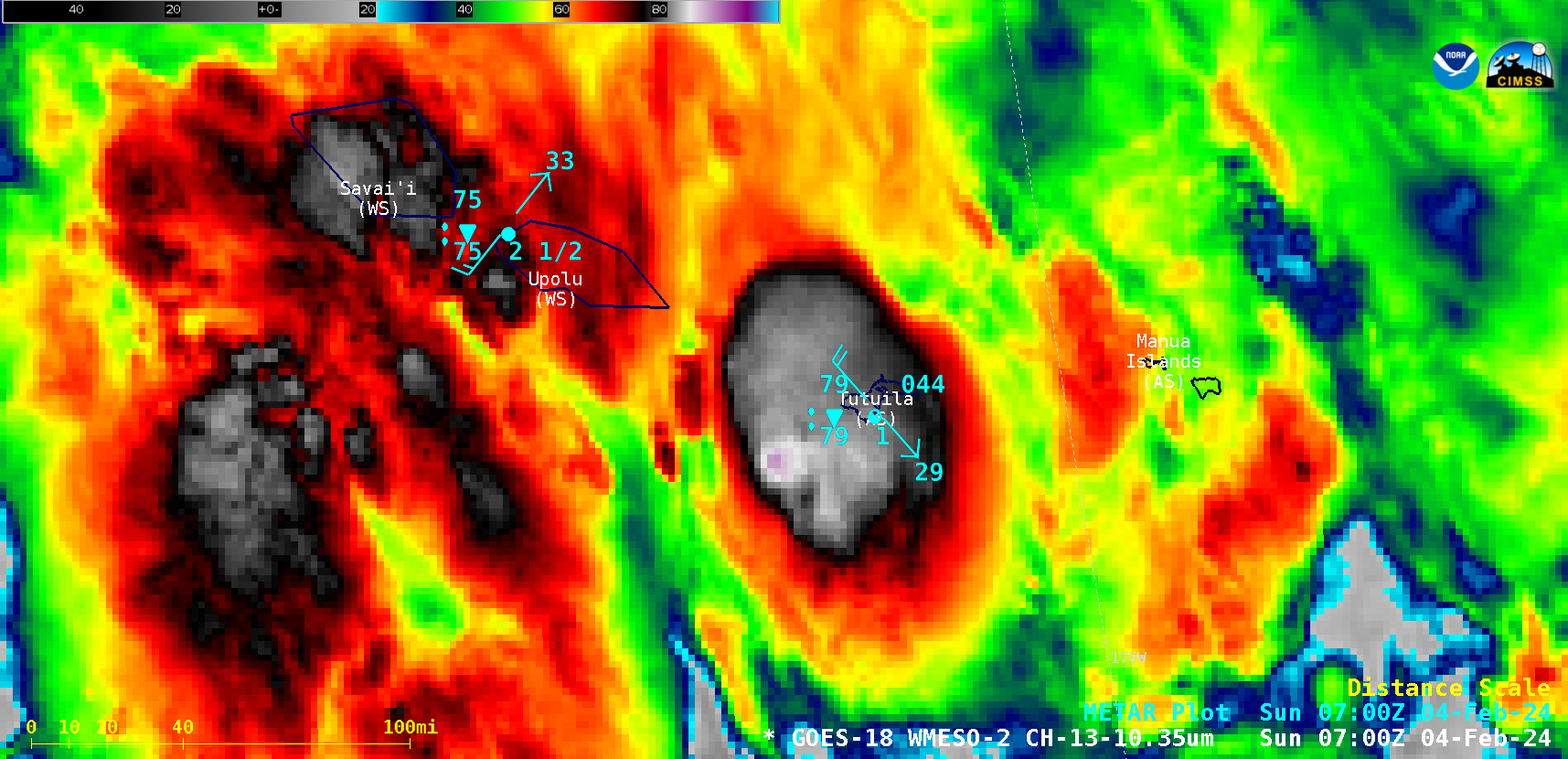
1-minute Mesoscale Domain Sector GOES-18 (GOES-West) “Clean” Infrared Window (10.3 µm) images (above) displayed a period of convective bursts near and over the American Samoa island of Tutuila on 04 February 2024 — which produced heavy rainfall (leading to flash flooding and landslides; during the 6-hour period ending at 1200 UTC, Pago Pago... Read More