Stable boundary layer roll clouds
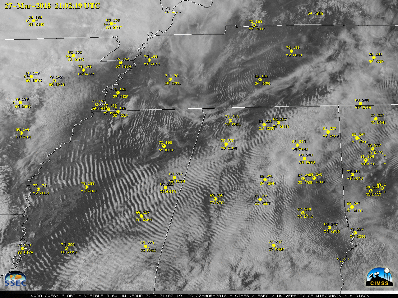
GOES-16 (GOES-East) “Red” Visible (0.64 µm) imagery (above) showed the formation of widespread stable boundary layer roll clouds across parts of Alabama, Mississippi, Georgia and Tennessee on 27 March 2018. With a relatively cool and stable boundary layer across the region, the gradual southwesterly return flow of moisture immediately above the surface (below)... Read More