Convective Development over the Upper Midwest
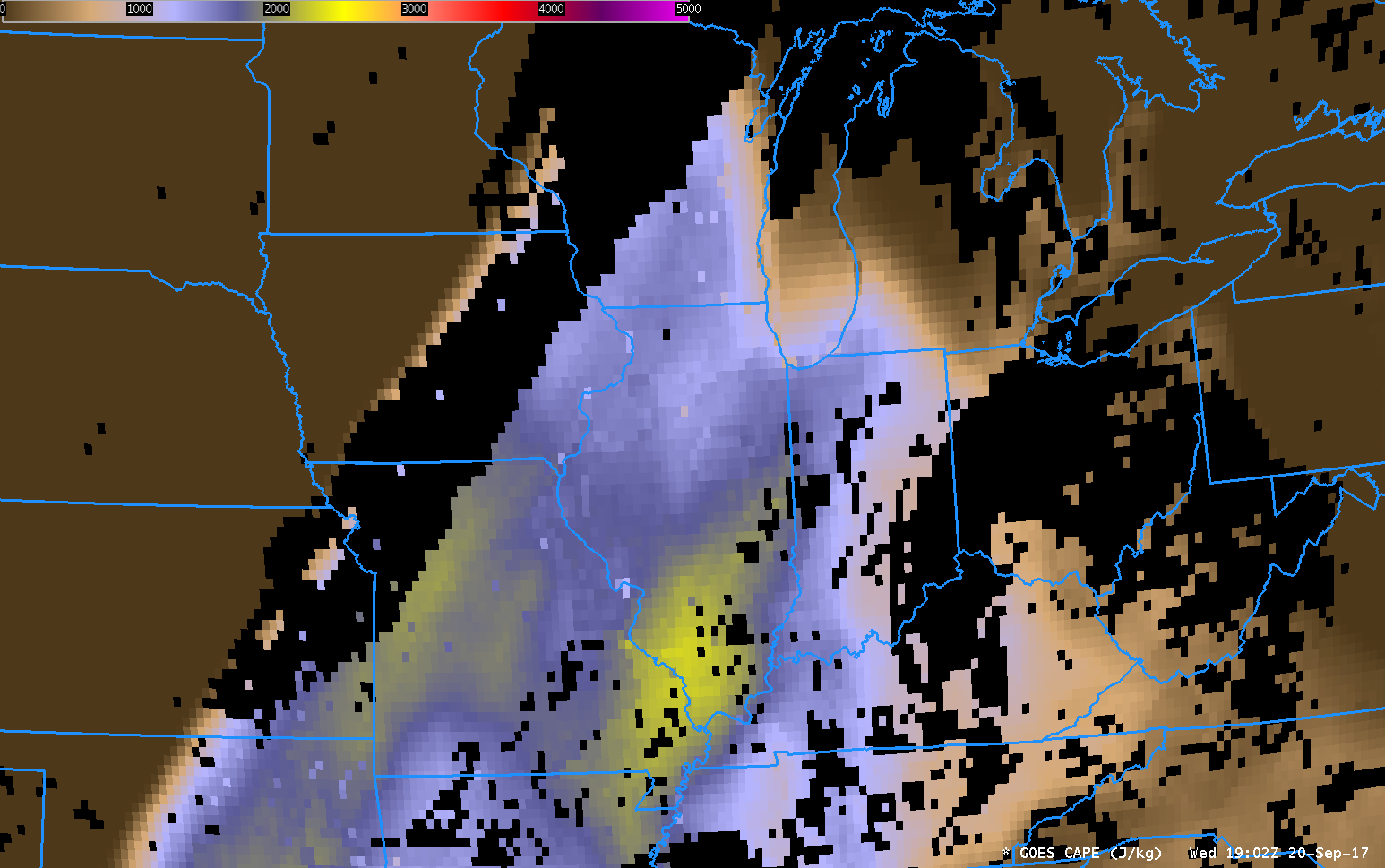
GOES-16 data posted on this page are preliminary, non-operational and are undergoing testingGOES-16 Data are used to create many Baseline Products that can be used to monitor and anticipate weather. The animation above shows the GOES-16 Convective Available Potential Energy (CAPE). Values increased by about 50-75% in a corridor from... Read More
