![GOES-13 Water Vapor (6.5 µm) images with METAR surface reports, surface fronts, and NAM40 500 hPa wind isotachs [click to play animation]](http://cimss.ssec.wisc.edu/satellite-blog/wp-content/uploads/2016/04/Reg_Water_Vapor_20160402_1145.png)
GOES-13 Water Vapor (6.5 µm) images with METAR surface reports, surface fronts, and NAM40 500 hPa wind isotachs [click to play animation]
GOES-13 Infrared Window (10.7 µm) images, with hourly surface weather symbols [click to play animation]
![]() ![]() |
|
Convective snow squalls in the Upper MidwestApril 2nd, 2016 | Scott Bachmeier
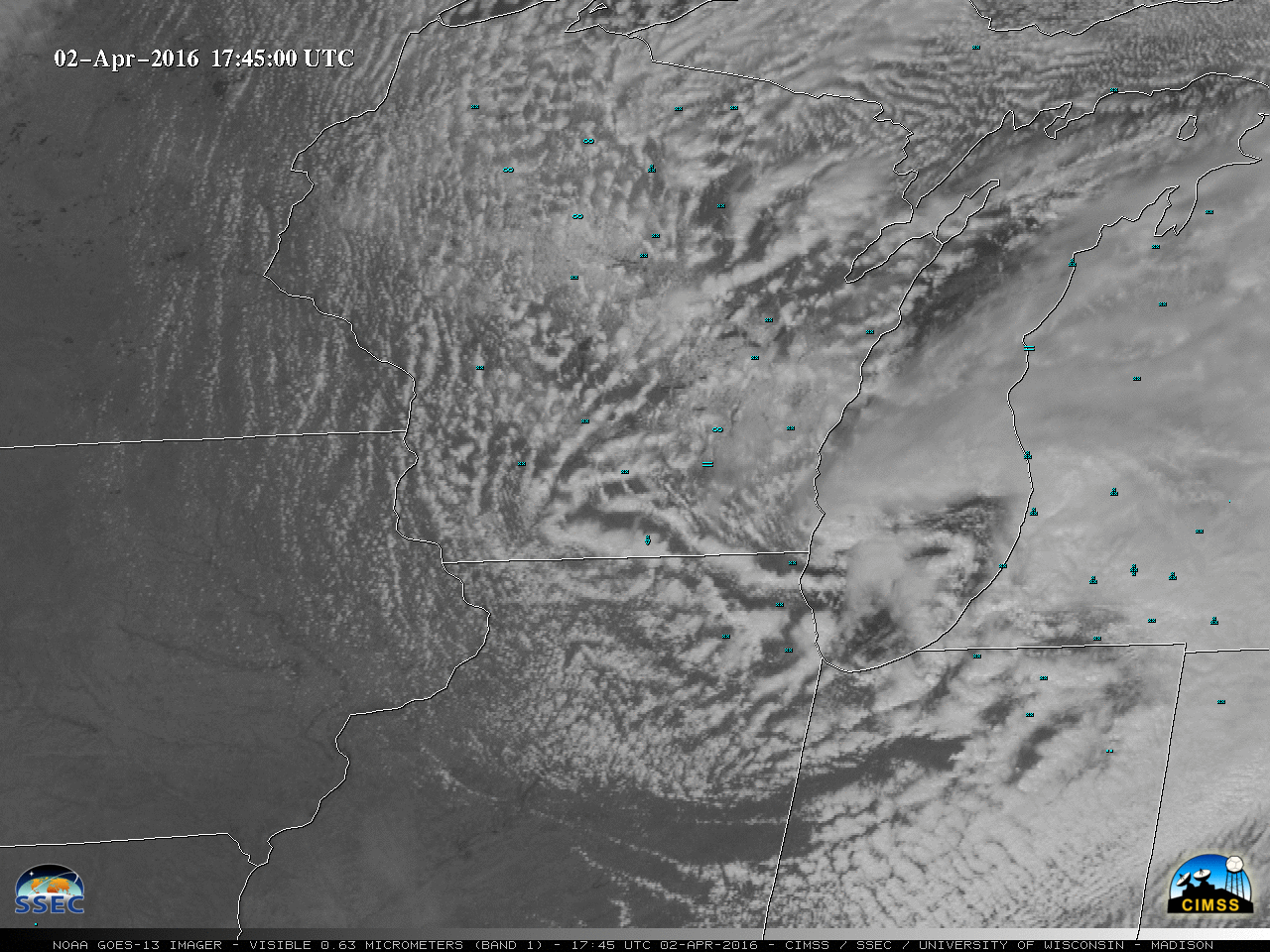
A vigorous clipper-type shortwave moved rapidly southeastward across the Upper Midwest on 02 April 2016; there were widespread convective elements associated with this system as seen in GOES-13 Visible (0.63 µm) images (above), which produced moderate to heavy snowfall at times (and even thundersnow) creating brief white-out conditions (time-lapse video from the AOSS rooftop camera in Madison, Wisconsin). A sequence of visible images from the polar-orbiting MODIS, VIIRS, and AVHRR instruments (below) provided another detailed view of these convective elements. This disturbance produced strong winds and accumulating snowfall; more information can also be found here from the NWS Chicago.
A pronounced warm/dry signature of middle-tropospheric subsidence (yellow color enhancement) was evident on GOES-13 Water Vapor (6.5 µm) images (below), which appeared to be along or just ahead of the areas of stronger wind gusts at the surface.
This area of middle-tropospheric subsidence was located along the leading edge of a strong (110-120 knot) 500 hPa jet, as indicated by the NAM40 model isotachs (below).
![]() GOES-13 Water Vapor (6.5 µm) images with METAR surface reports, surface fronts, and NAM40 500 hPa wind isotachs [click to play animation] GOES-13 Infrared Window (10.7 µm) images, with hourly surface weather symbols [click to play animation] |
|