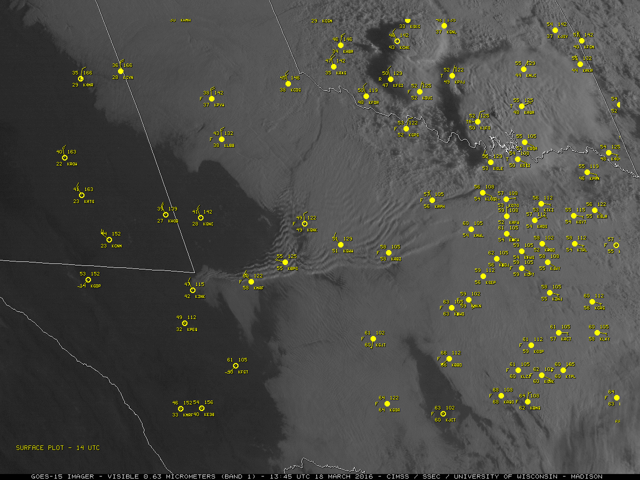
A nighttime Suomi NPP VIIRS Day/Night Band image at 0814 UTC or 3:14 am local time (below) showed the early stage of bore wave cloud formation over the Texas Panhandle. Due to ample illumination from the Moon (in the Waxing Gibbous phase, at 78% of Full), this example illustrated the “visible image at night” capability of the Day/Night Band.
CLAVR-x POES AVHRR Cloud Top Temperature and Cloud Top Height products (below) indicated values of around +6º C and 2 km, respectively, for the undular bore wave cloud features ahead of the cold front at 1714 UTC. The 2 km cloud top height was consistent with the depth of the stable layers seen above the surface seen in rawinsonde data profiles at Midland (KMAF) and Forth Worth (KFWD), 2 locations which were ahead of the cold frontal boundary at 1200 UTC.![Midland (KMAF) and Fort Worth (KFWD) rawinsonde data profiles at 1200 UTC [click to enlarge]](http://cimss.ssec.wisc.edu/satellite-blog/wp-content/uploads/2016/03/160318_1200utc_Midland_Fort_Worth_TX_soundings_anim.gif)
Midland (KMAF) and Fort Worth (KFWD) rawinsonde data profiles at 1200 UTC [click to enlarge]