Why 1-minute satellite data matters: Monitoring Fires
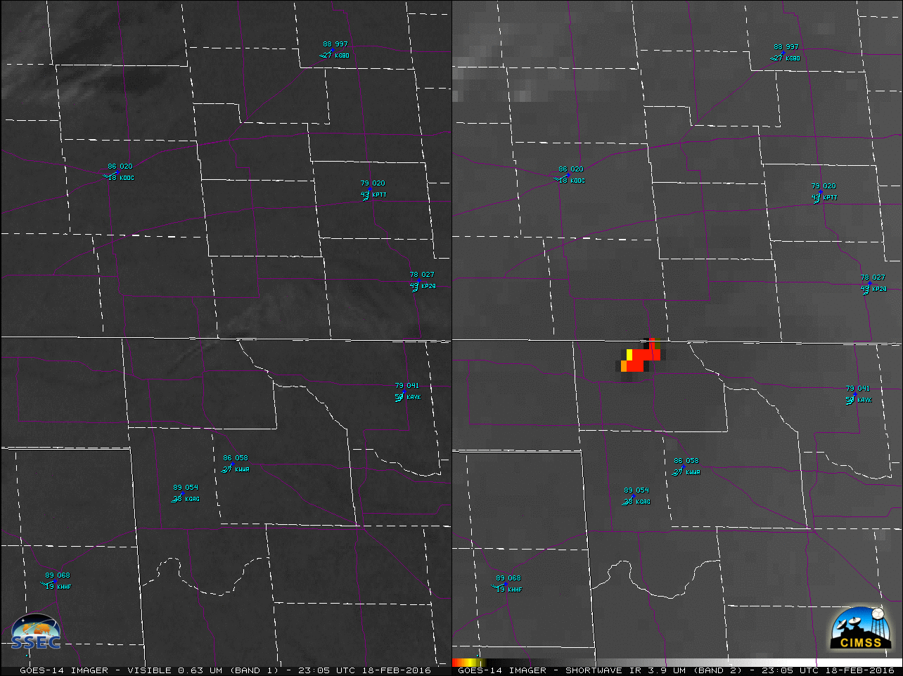
Extensive wildfires (well-forecast by the Storm Prediction Center) occurred over the southern Plains on Thursday 18 February 2016, while GOES-14 was operating in SRSO-R mode. A comparison of 1-minute GOES-14 Visible (0.63 µm) and Shortwave Infrared (3.9 µm) images (above; also available as a large 112 Mbyte animated GIF) showed the broad areal coverage of smoke plumes and fire... Read More
