Flooding in the Missouri/Mississippi/Ohio River basins
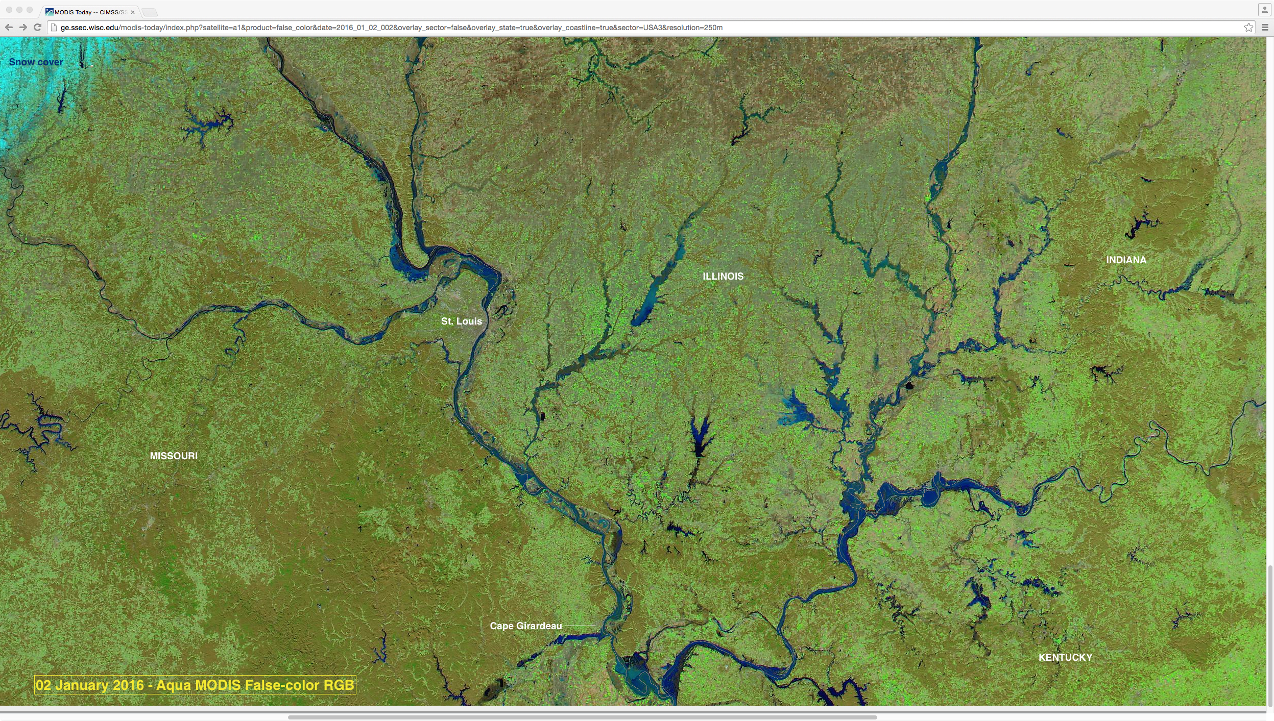
A comparison of 250-meter resolution Aqua MODIS false-color Red/Green/Blue (RGB) images from the SSEC MODIS Today site on 19 December 2015 and 02 January 2016 (above) showed large increases in the width of portions of the Missouri/Mississippi/Ohio Rivers (as well as many of their tributaries and surrounding lakes) during that 14-day period. These false-color images use... Read More
