Industrial plumes producing light snow in Wisconsin
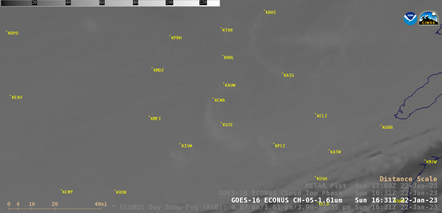
GOES-16 (GOES-East) Near-Infrared “Snow/Ice” (1.61 µm) images (above) displayed industrial plumes (from sources such as power plants) that produced brief periods of light snow as they drifted over a few sites in northern Wisconsin on 22 January 2023. Particles emitted from industrial stacks acted as cloud condensation nuclei, “seeding” the surrounding supercooled water cloud... Read More
