This website works best with a newer web browser such as Chrome, Firefox, Safari or Microsoft Edge. Internet Explorer is not supported by this website.

Category: Software

CSPP Geo Software to create LightningCast imagery released

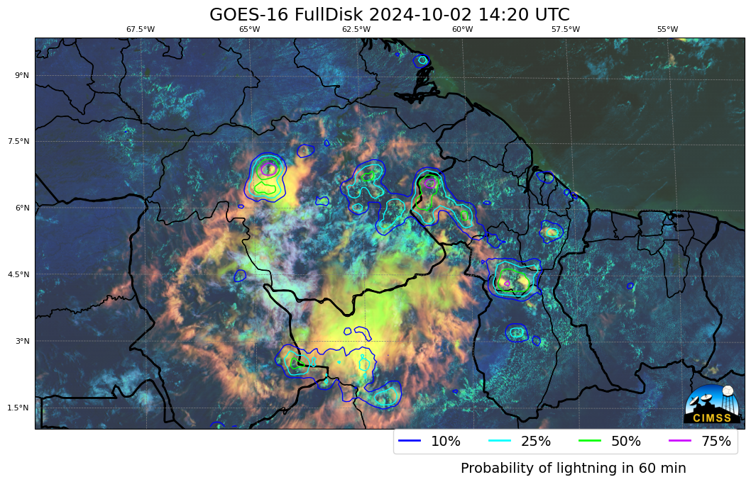
As first hinted at in this blog post, the Community Satellite Processing Package for Geostationary Data (CSPP-Geo) (https://cimss.ssec.wisc.edu/csppgeo/ ) group at CIMSS has released a beta version of a unix-based package that computes LightningCast probabilities.  LightningCast (available online in real time for select regions) diagnoses the probability of a Geostationary Lightning Mapper (GLM) observation of lightning within... Read More

Creating AMSR-2 imagery to overlay on top of GOES imagery

Geo2grid software was used to create the three true-color animations below, using GOES-16 Full-Disk Level-1b Radiance data over the tropical Atlantic. ABI gives a vivid representation of the cloud patterns associated with a tropical wave developing (near 35oW on 27 June, near 40oW on 28 June, and approaching 50oW on... Read More