Severe thunderstorm over the Black Hills of South Dakota
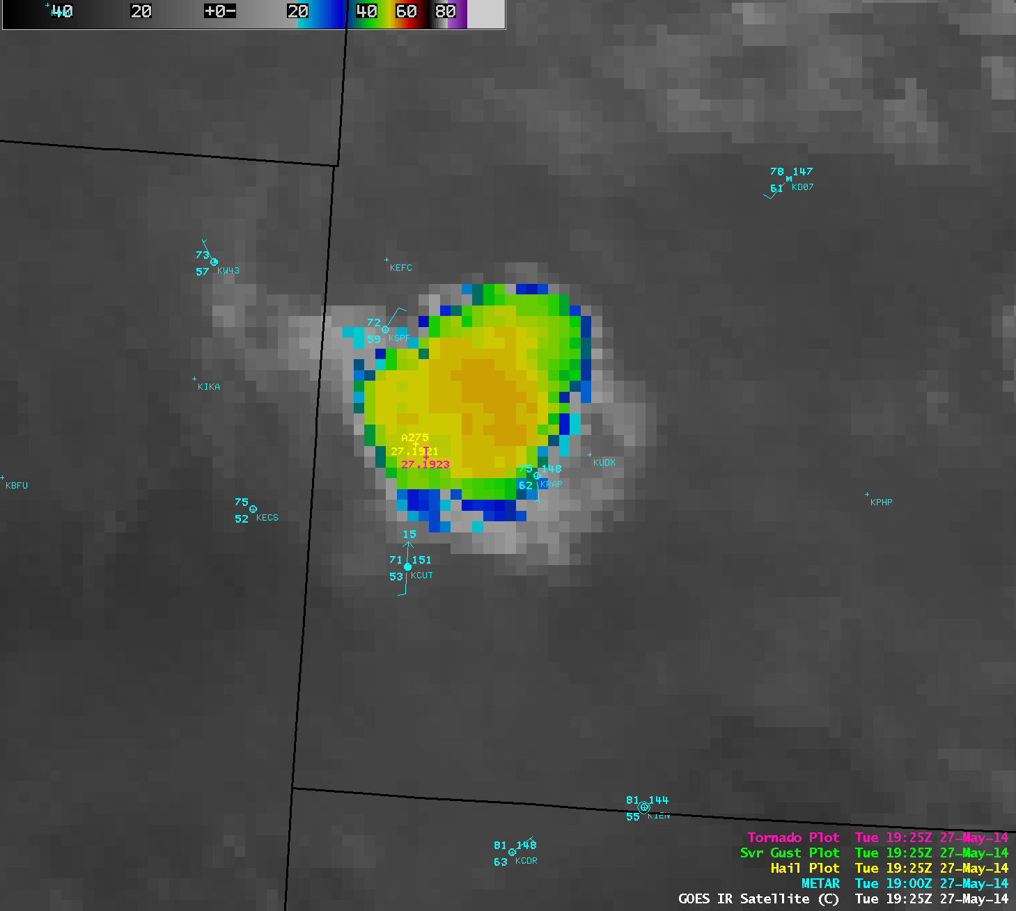
An isolated severe thunderstorm developed over the northern portion of the Black Hills of South Dakota around 18 UTC (Noon local time) on 27 May 2014, and moved southeastward producing hail as large as 2.75 inches in diameter and a tornado (Read More
