Large hail in Argentina
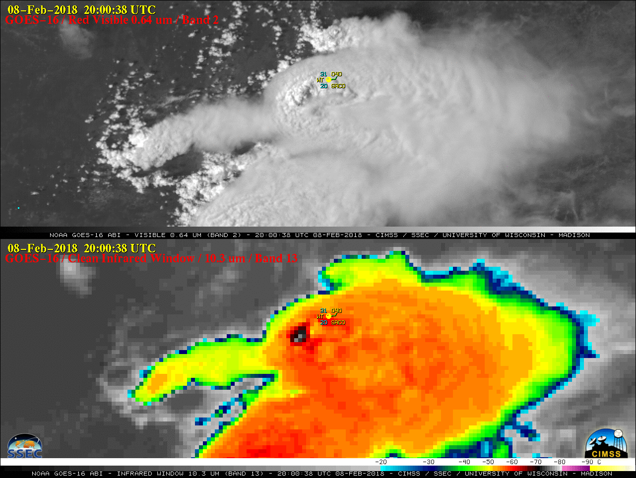
GOES-16 (GOES-East) “Red” Visible (0.64 µm) and “Clean” Infrared Window (10.3 µm) images (above) showed the development of severe thunderstorms which produced very large hail in the Córdoba, Argentina area on 08 February 2018. Distinct above-anvil cirrus plumes were evident on the Visible imagery, with pulses of overshooting tops exhibiting Infrared brightness temperatures in... Read More