This website works best with a newer web browser such as Chrome, Firefox, Safari or Microsoft Edge. Internet Explorer is not supported by this website.

Category: Red-Green-Blue (RGB) images

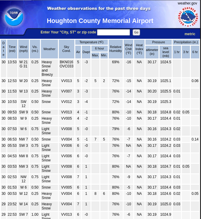
Lake effect Bands and one Convergence Band over Lake Superior

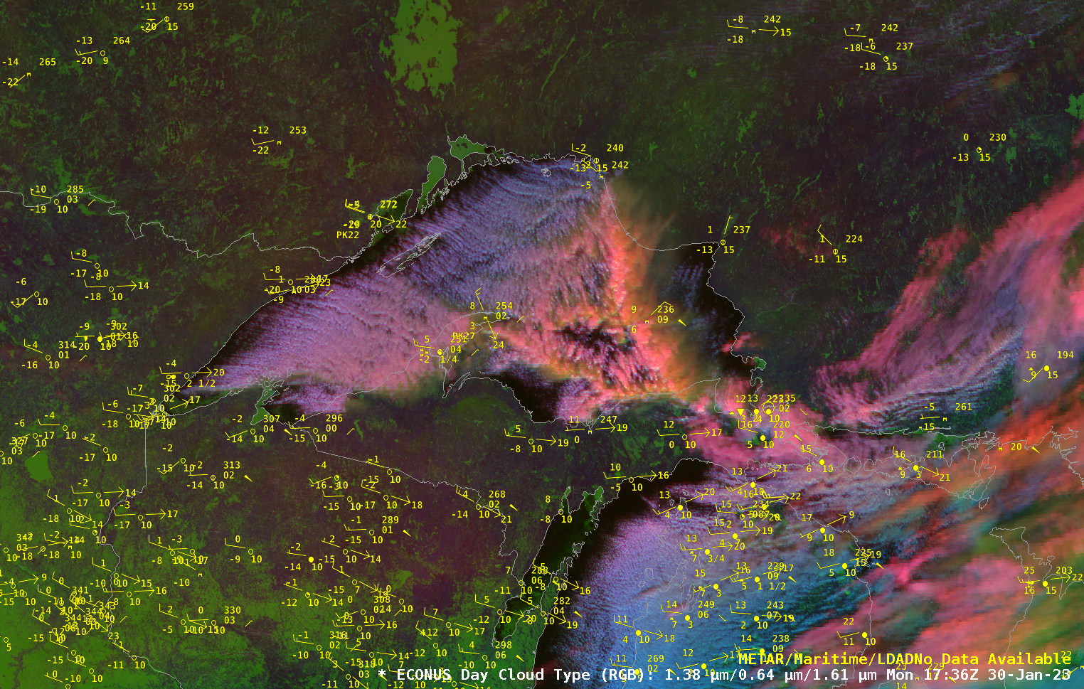
An animation of the Day Cloud Type RGB over Lake Superior on 30 January 2023, above, shows two prominent features: persistent lake-effect bands oriented west-northwest to east-southeast over the western four-fifths of the Lake (station KCMX on the Keewenaw peninsula, for example, observed heavy snow during this animation), and a more north-south oriented convergence band that extends from the eastern Upper Peninsula of... Read More

Widespread fog/stratus over snow cover across the Northern Plains

A sequence of GOES-16 (GOES-East) “Red” Visible (0.64 µm), Day Cloud Phase Distinction RGB and Day Snow-Fog RGB images (above) showed widespread fog/stratus across parts of Montana, North/South Dakota and Minnesota during the day on 06 January 2023. With a quasi-stationary area of high pressure located over that area (surface analyses), winds remained light and the fog/stratus layer was slow... Read More