SAR winds over Cyclone Judy on 2 March 2023
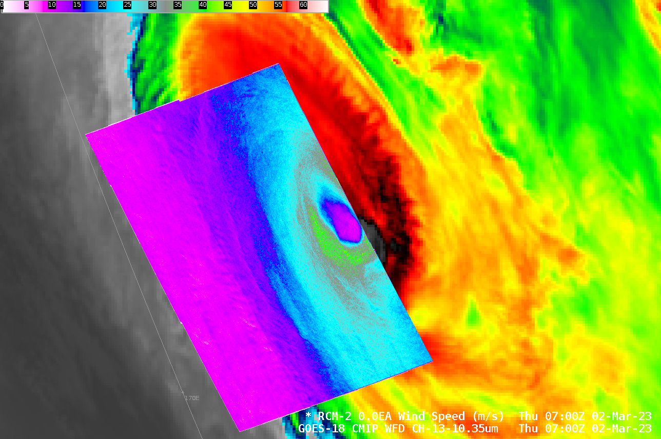
The Synthetic Aperture Radar instrument on RADARSAT Constellation Mission-2 (RCM-2) satellite sampled the winds over the western half of Cyclone Judy at 0700 UTC on 2 March 2023, as shown in the toggle above that also includes the GOES-18 Band 13 Clean Window infrared (10.3 µm) imagery. Peak winds are 41 m/s in the southern eyewall, and strongest winds are in general in the southern part... Read More
