This website works best with a newer web browser such as Chrome, Firefox, Safari or Microsoft Edge. Internet Explorer is not supported by this website.

Category: NOAA-20

Mesoscale Convective System in Argentina

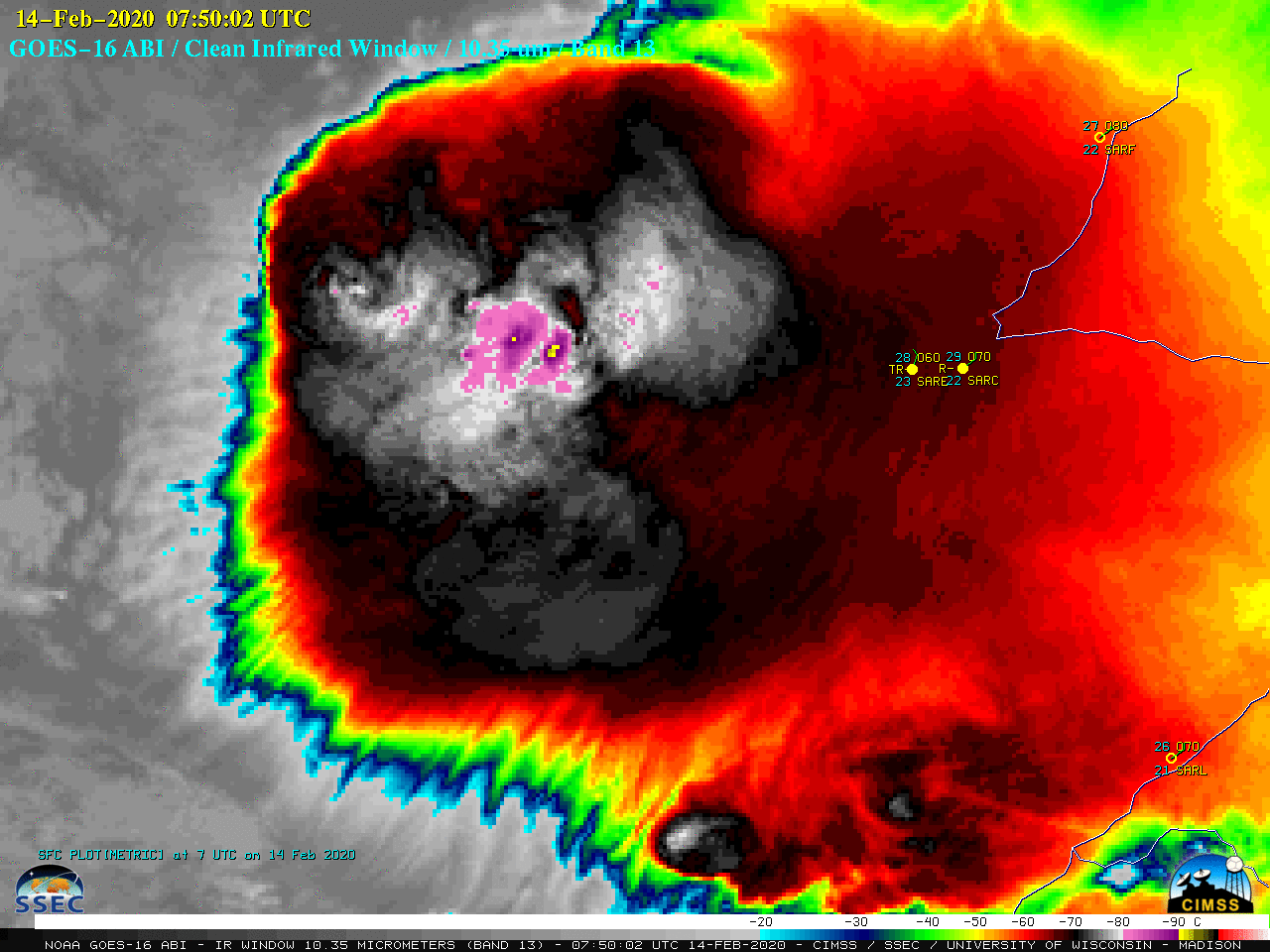
GOES-16 (GOES-East) “Clean” Infrared Window (10.35 µm) images (above) showed a large Mesoscale Convective System (MCS) west of Resistencia (station identifier SARE) in far northern Argentina on 14 February 2020 — this MCS developed southeast of an area of low pressure that was situated well north of a slow-moving cold front... Read More

Can you use gridded NUCAPS fields to diagnose the rain/snow line?

Gridded NUCAPS fields include a wide range of thermodynamic variables. The plot above shows the 900-mb temperature field. Is it possible to use this data to diagnose a rain/snow transition line? Over southern New England, the relationship between 900-mb temperatures and surface precipitation observations seems robust: snow is restricted to... Read More

Ozone Estimates from NUCAPS

Gridded NOAA-Unique Combined Atmospheric Processing System fields in AWIPS (and elsewhere, such as this excellent site) include retrieved values of ozone (O3), an important gas.  In high concentrations in the upper troposphere, O3 is a marker for the presence of stratospheric air.  In the animation above, high concentrations of ozone are present... Read More