Mountain waves and a banner cloud over the Northeast US
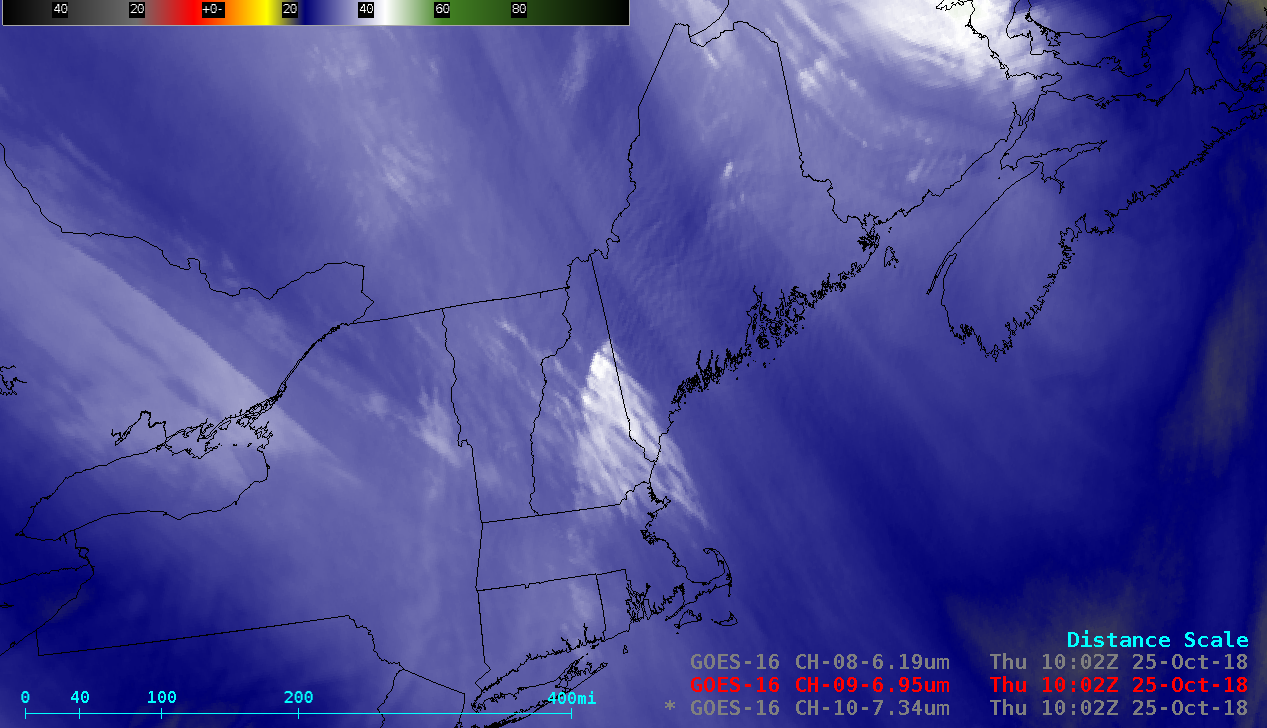
GOES-16 (GOES-East) Low-level (7.3 µm), Mid-level (6.9 µm) and Upper-level (6.2 µm) Water Vapor images (above) revealed 2 types of terrain-induced features — mountain waves, and a banner cloud (reference 1| | reference 2) — across the Northeast US on 25 October 2018.The mountain waves were more widespread and long-lasting, while the banner cloud formed to the... Read More
