Category: Microwave

Post-Tropical Cyclone Kiko north of Hawai’i
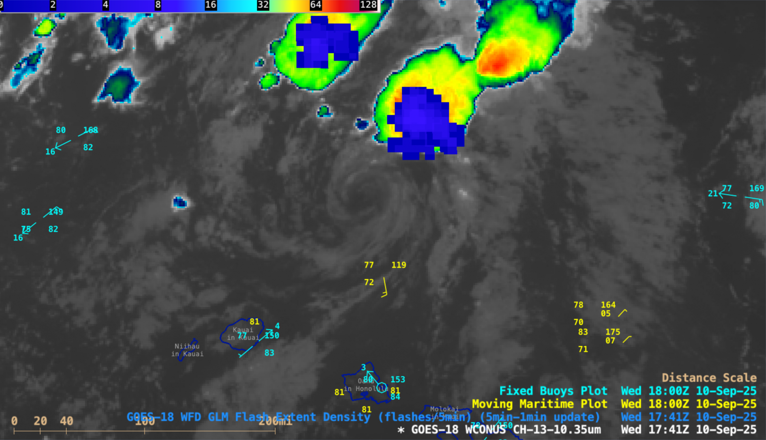
5-minute CONUS Sector GOES-18 (GOES-West) Infrared images (above) revealed the exposed low-level circulation center (LLCC) of Tropical Storm Kiko as the system continued to weaken north of the Hawaiian island of Oahu, and downgraded to a Post-Tropical Cyclone at 1500 UTC on 10 September 2025. Clusters of deep convection developed north... Read More
Hurricane Kiko rapidly intensifies to a Category 4 storm in the East Pacific Ocean
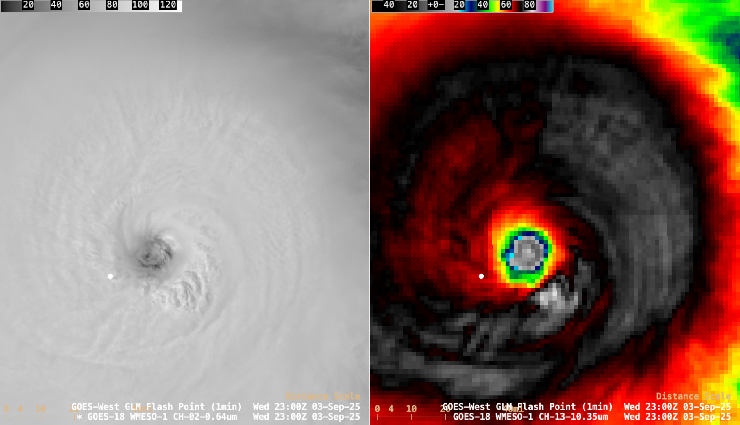
1-minute Mesoscale Domain Sector GOES-18 (GOES-West) Visible and Infrared images (above) showed the westward motion of of Hurricane Kiko during an 8.5-hour period as the tropical cyclone was rapidly intensifying (SATCON) from a Category 2 storm at 1500 UTC on 03 September 2025 to a Category 3 storm at 1800 UTC and... Read More
Catastrophic flash flooding event in the Hill Country of Texas responsible for at least 130 fatalities

5-minute CONUS Sector GOES-19 (GOES-East) Infrared images displayed using RealEarth (above) showed the clusters of thunderstorms that produced up to 9.40″ of rainfall near Ingram (located between Hunt and Kerrville) in Kerr County, Texas during the 24-hour period ending at 1700 UTC (Noon local time) on 04 July 2025. The resulting flash flooding was... Read More
