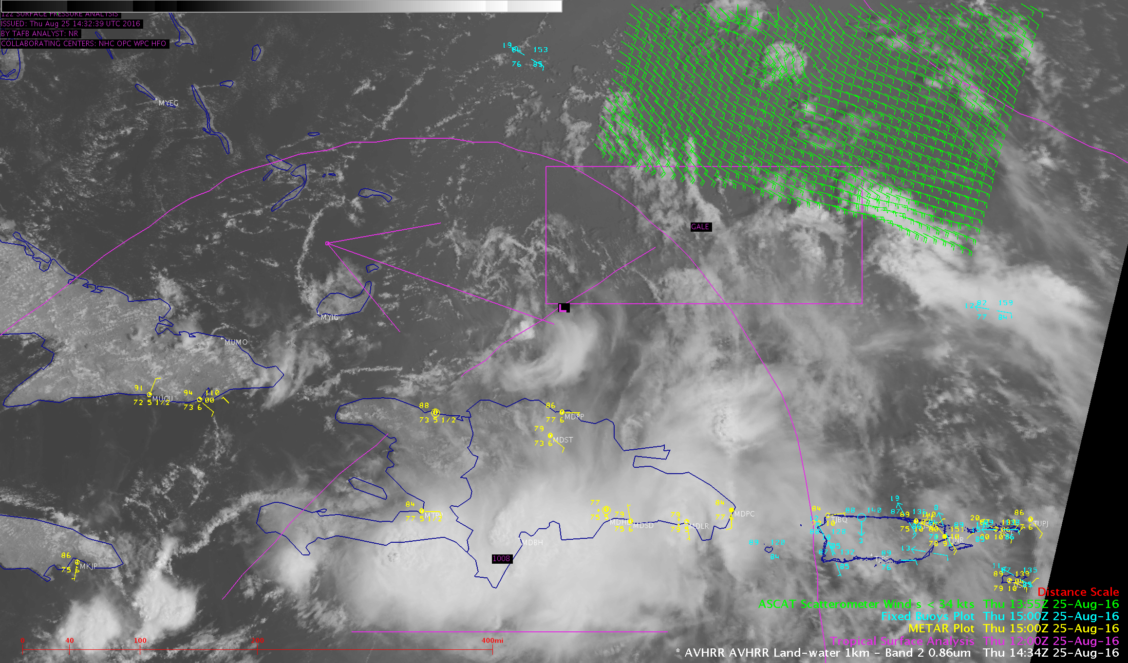
GOES-14 SRSO-R: Tropical Disturbance near the Caribbean
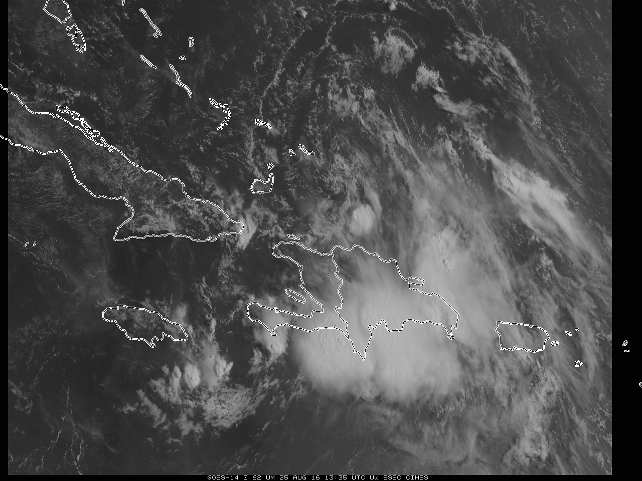
GOES-14 SRSO-R Imagery is being produced over the Greater Antilles on 25 August 2016 to monitor a tropical wave (Invest 99L) that is moving towards Florida and the southeast United States. The visible animation above shows a highly sheared system: a low-level circulation center (LLCC) is evident north of Hispaniola and east of... Read More
