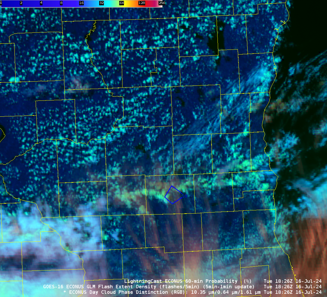
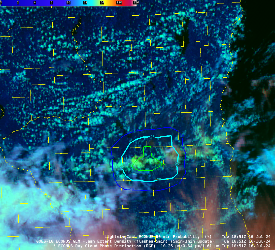
LightningCast probabilities over southern Wisconsin
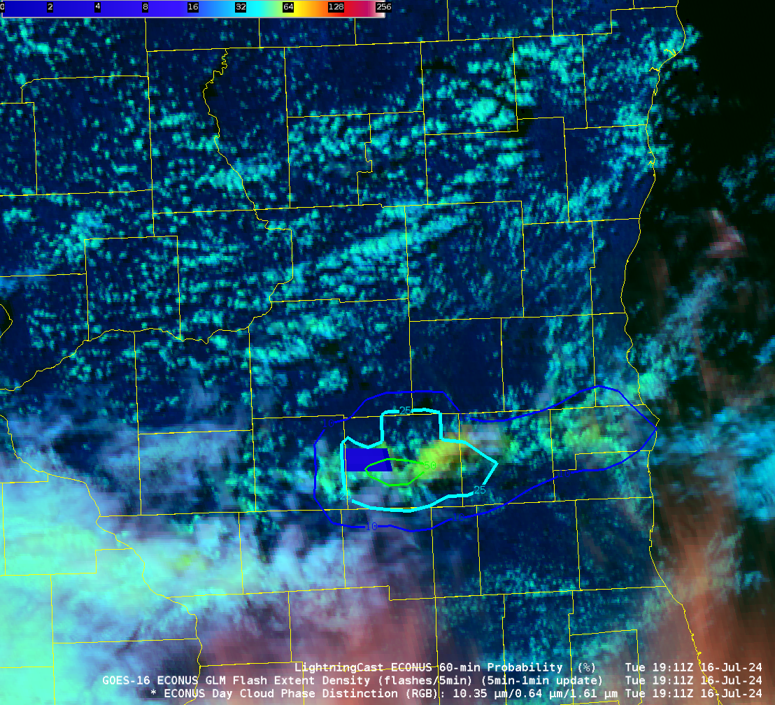
Day Cloud Phase Distinction imagery, above, from the GOES-16 CONUS Sector, shows the development of convection along the southern tier of counties in Wisconsin. LightningCast probabilities (the probability that a GLM observation will occur within the next 60 minutes) start to ramp up shortly after 1800 UTC, a 10% contour appears at 1826 UTC (in Rock County over southern Wisconsin), a 50% contour at 1851 UTC. The... Read More
