Category: LightningCast
NGFS detection of lightning-induced fires over Wyoming

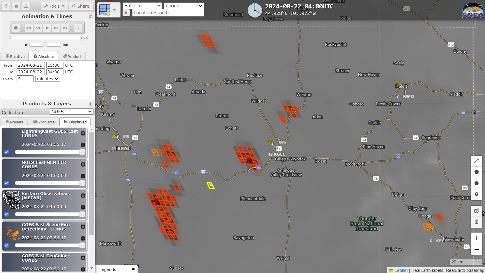
GOES-18 True-Color imagery, above, from the CSPP Geosphere website (link to animation above), shows convection moving over northeastern Wyoming, leaving in its wake a series of smoke plumes: wildfires caused by lightning. The screenshots below were captured from the Real Earth instance of NGFS imagery (link), and they show LightningCast probability and Flash... Read More
LightningCast probabilities over southern Wisconsin

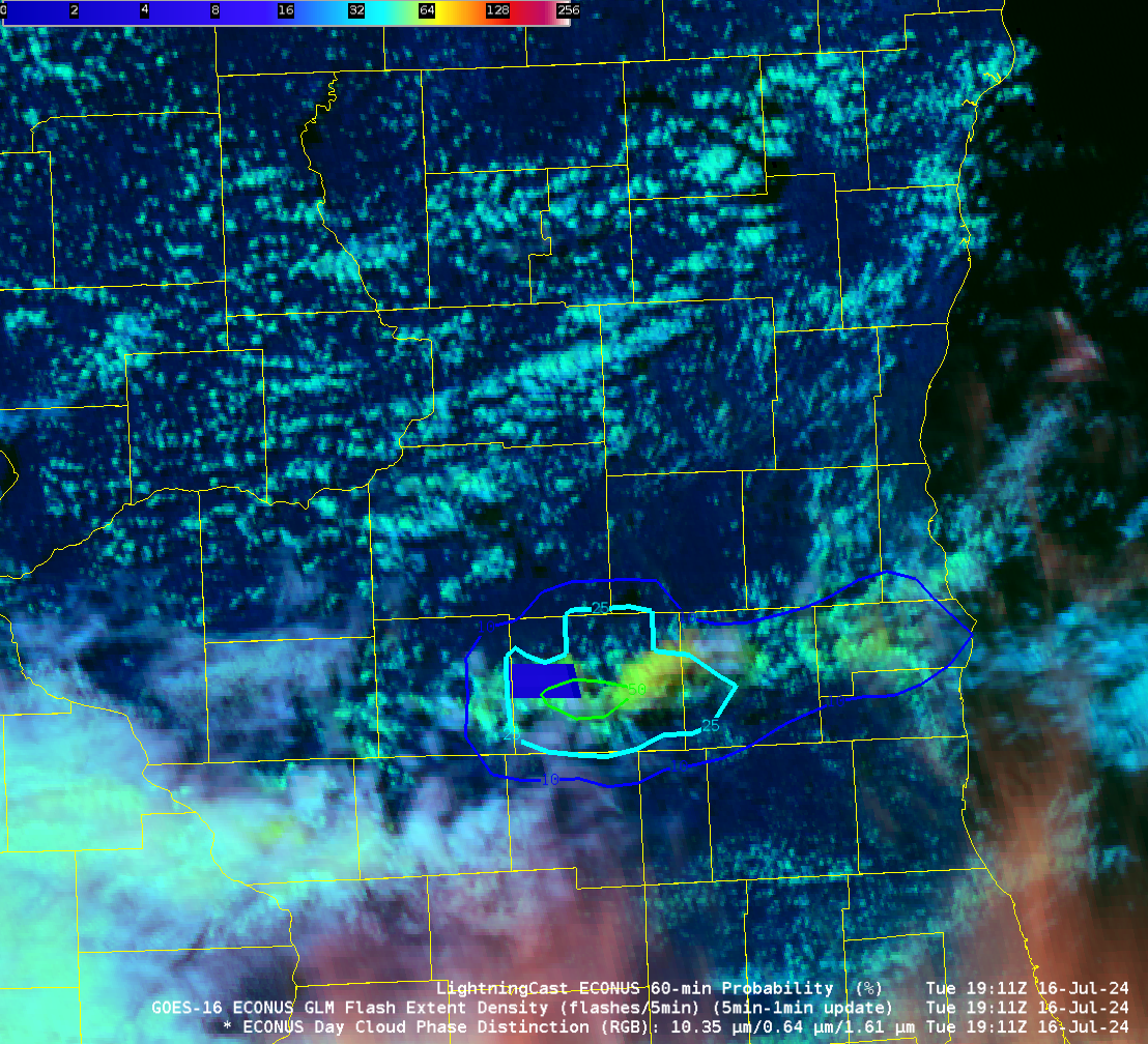
Day Cloud Phase Distinction imagery, above, from the GOES-16 CONUS Sector, shows the development of convection along the southern tier of counties in Wisconsin. LightningCast probabilities (the probability that a GLM observation will occur within the next 60 minutes) start to ramp up shortly after 1800 UTC, a 10% contour appears at 1826 UTC (in Rock County over southern Wisconsin), a 50% contour at 1851 UTC. The... Read More
Using LightningCast Probabilities as an aviation tool

This blog post shows satellite imagery with a Singapore Airlines Boeing 777-300ER that encountered severe turbulence while flying over southern Myanmar (information from flightradar) at 0749 UTC on 21 May 2024. This graphic from Sarah Griffin, CIMSS, shows the turbulence location/time; other graphics/animations from this event are in this directory that Sarah Griffin created.LightningCast probabilities... Read More