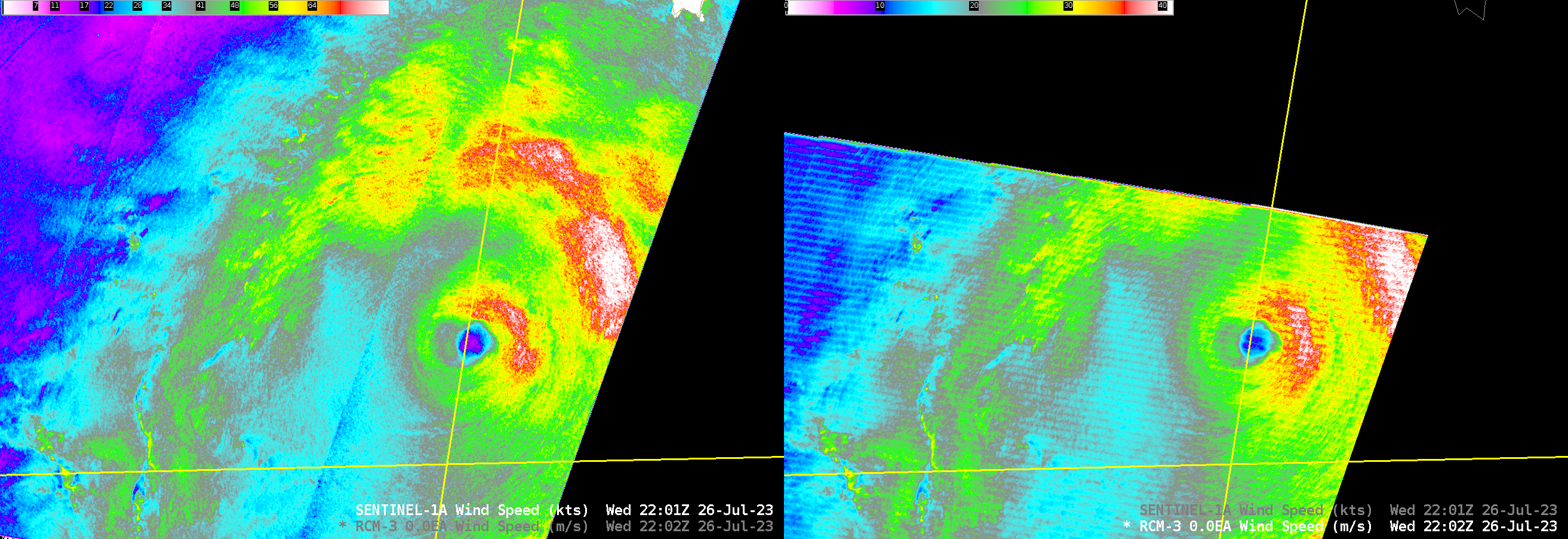
Typhoon Khanun passes just south of Okinawa Island
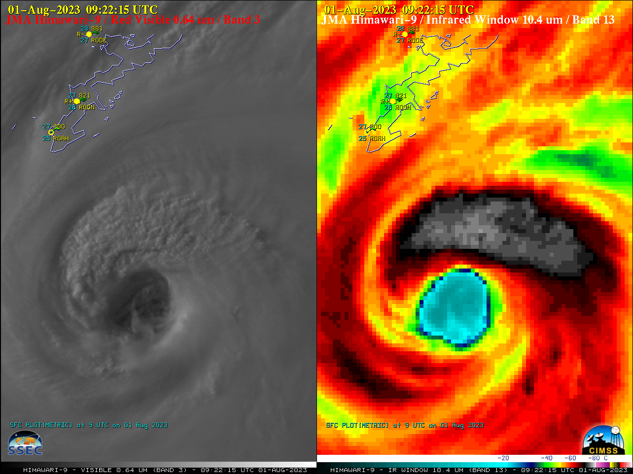
Target Sector (2.5-minute interval) JMA Himawari-9 AHI Visible and Infrared images (above) showed Category 4 Typhoon Khanun as it moved just south of Okinawa Island from 0502-1002 UTC on 01 August 2023. Visible images depicted mesovortces within the eye.During that 0502-1002 UTC time period, peak wind gusts at the 3 METAR sites located in... Read More