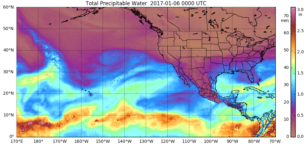
Atmospheric river events bring heavy precipitation to California
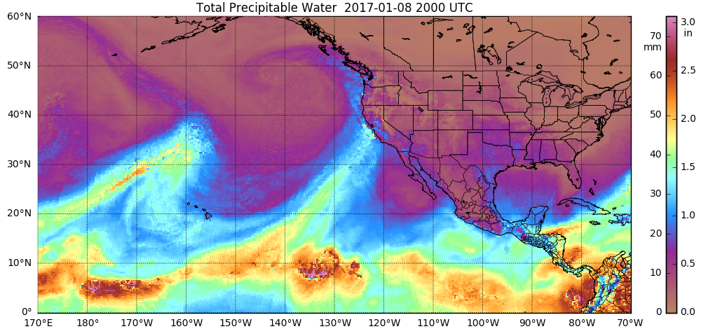
A series of 3 atmospheric river events brought heavy rainfall and heavy snowfall to much of California during the first 10 days of January 2017 (NWS San Francisco/Monterey | WeatherMatrix blog). Hourly images of the MIMIC Total Precipitable Water product (above; also available as a 33 Mbyte animated GIF) showed the second and third of these atmospheric river... Read More
