Using GOES-16 Baseline Products to anticipate where heavy rain might fall
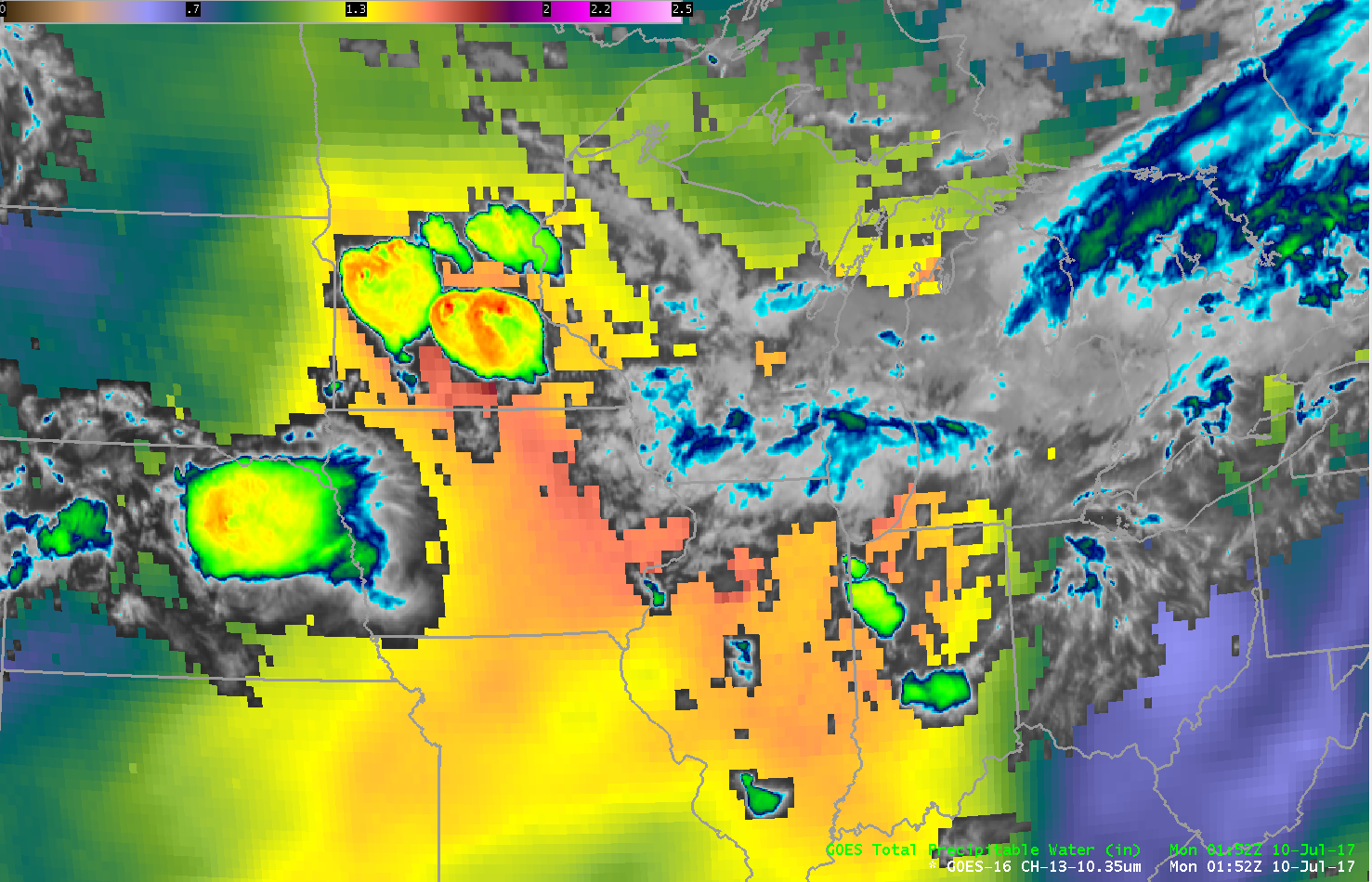
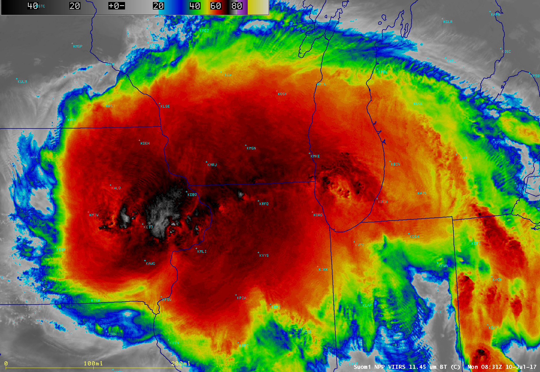
GOES-16 data posted on this page are preliminary, non-operational and are undergoing testingVery heavy rain (4-5″) fell over parts of southwestern Wisconsin early on 10 July 2017 as a Mesoscale Convective System traversed the Upper Midwest (0831 UTC VIIRS Infrared vs Day/Night Band). The animation above blends the Clean Window (10.3 µm) from GOES-16... Read More
