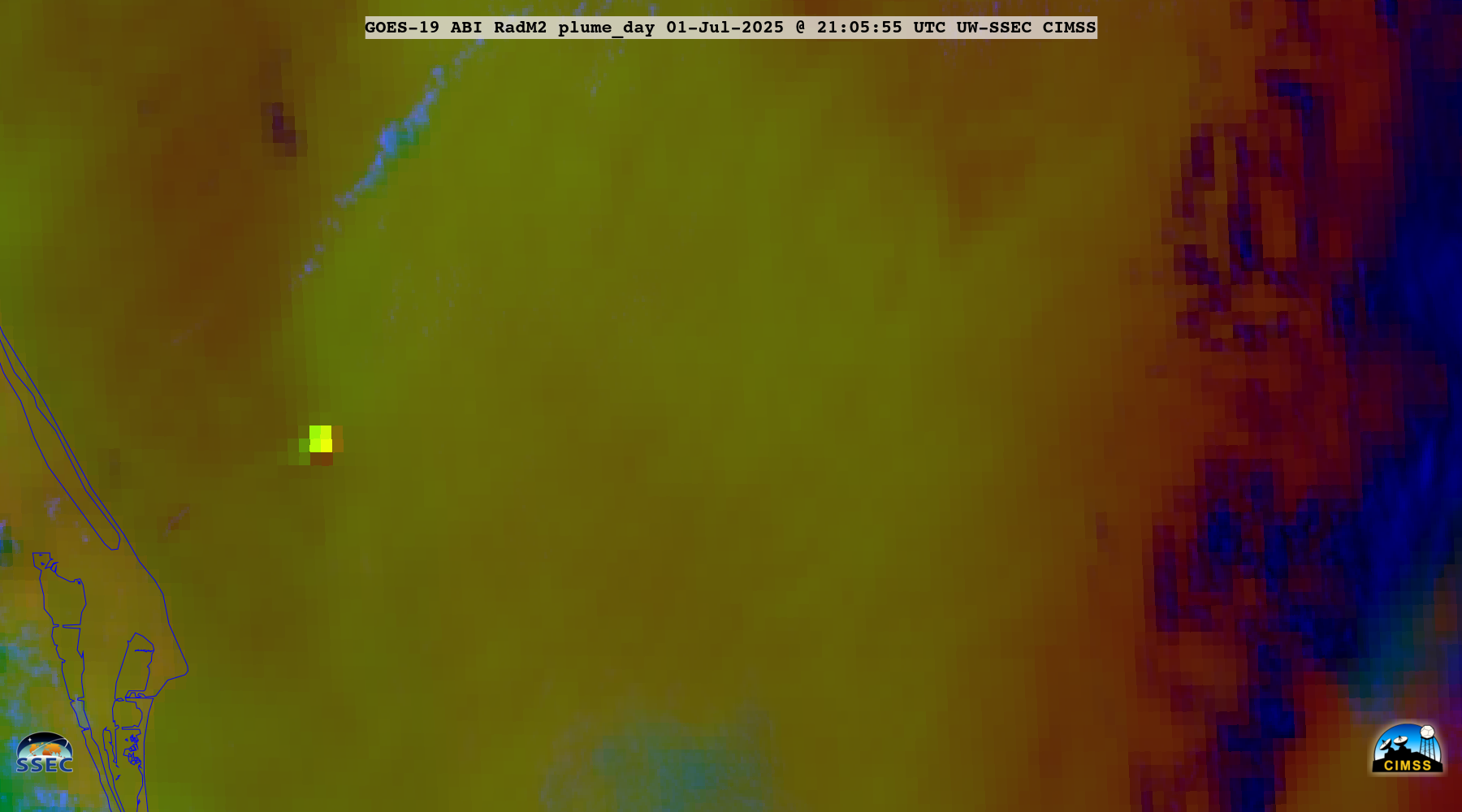
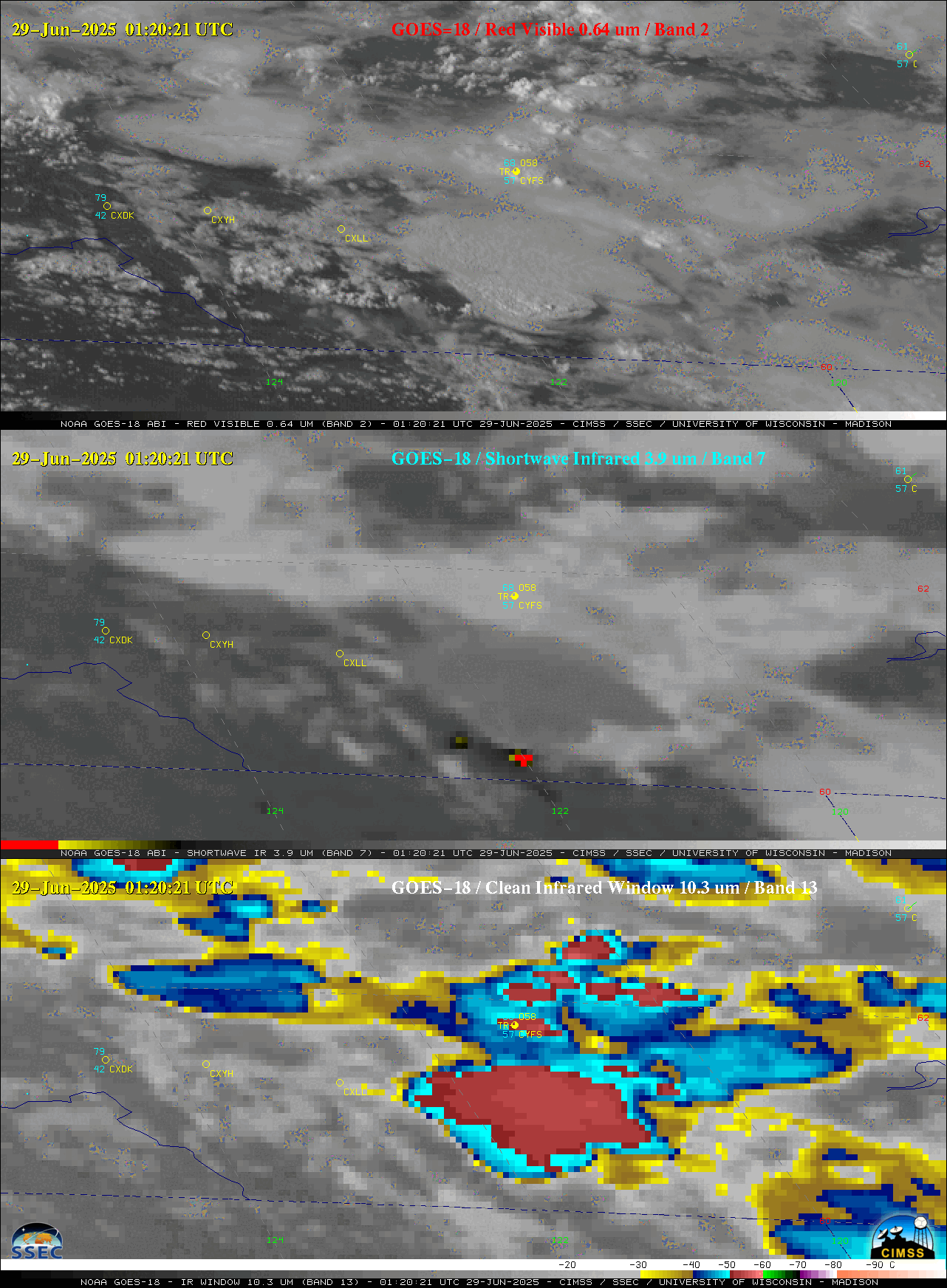
Explosion at a fireworks warehouse in Esparto, California
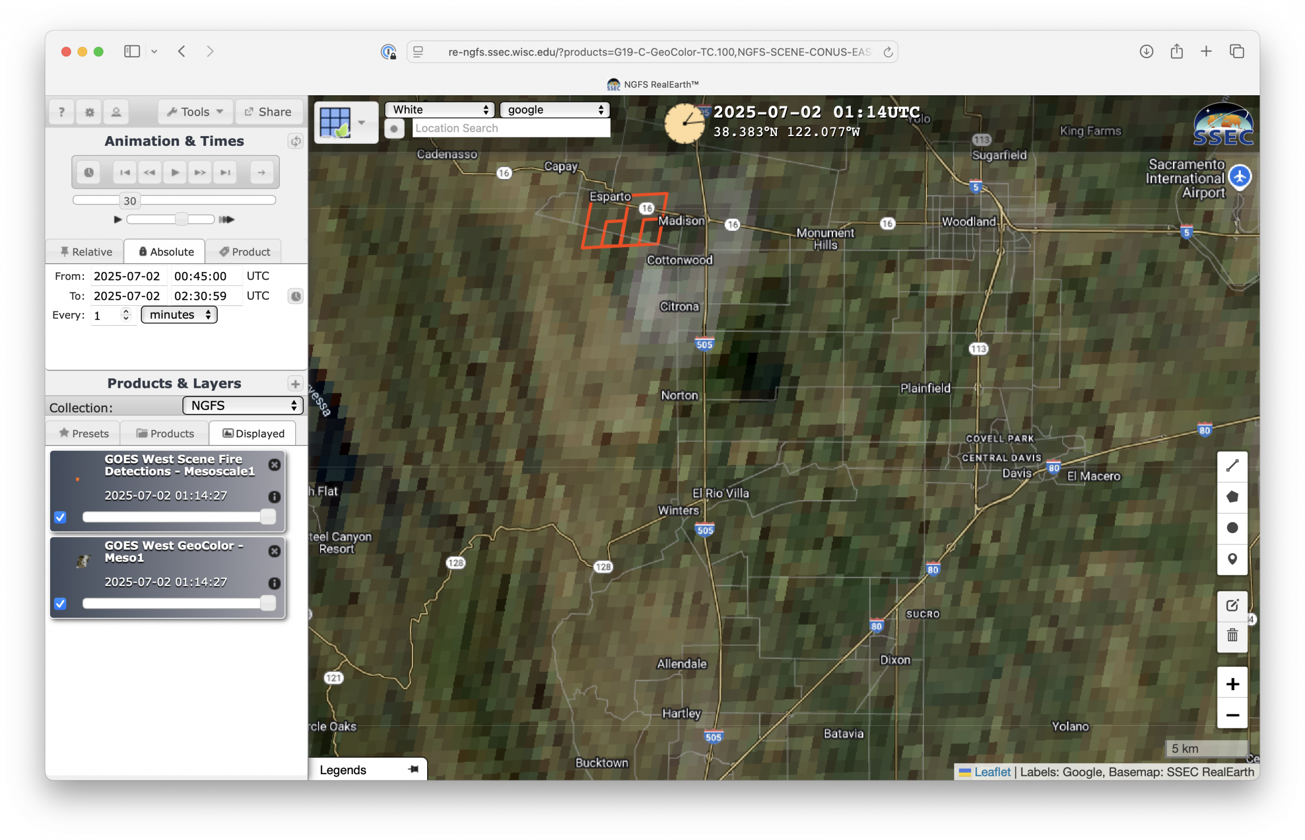
A major explosion at a fireworks warehouse in Esparto, California occurred late in the afternoon on 01 July 2025, injuring 2 with 7 people remaining unaccounted for (media report). The robust thermal signature of the resulting fire was detected by the Next Generation Fire System (NGFS), using both 1-minute Mesoscale Domain Sector GOES-18 (GOES-West)... Read More

