Satellite signatures of a NASA SLS rocket core stage test
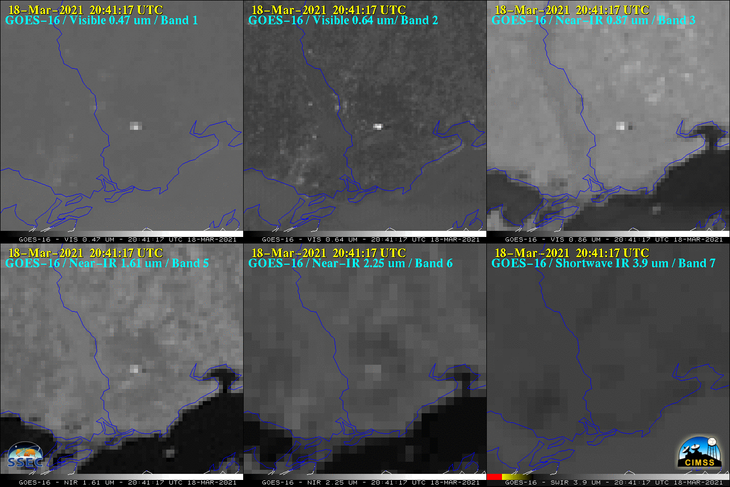
NASA conducted a SLS rocket Green Run Test at Stennis Space Center in southern Mississippi on 18 March 2021. The test began at 2037 UTC, with the engine burn lasting about 8 minutes. Signatures of the resulting condensation cloud (brighter shades of white) were evident in GOES-16 (GOES-East) ABI spectral bands 1 (0.47 µm),... Read More
