This website works best with a newer web browser such as Chrome, Firefox, Safari or Microsoft Edge. Internet Explorer is not supported by this website.

Category: GOES-16

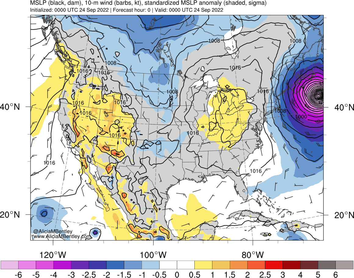
Ian and Charley eye comparison

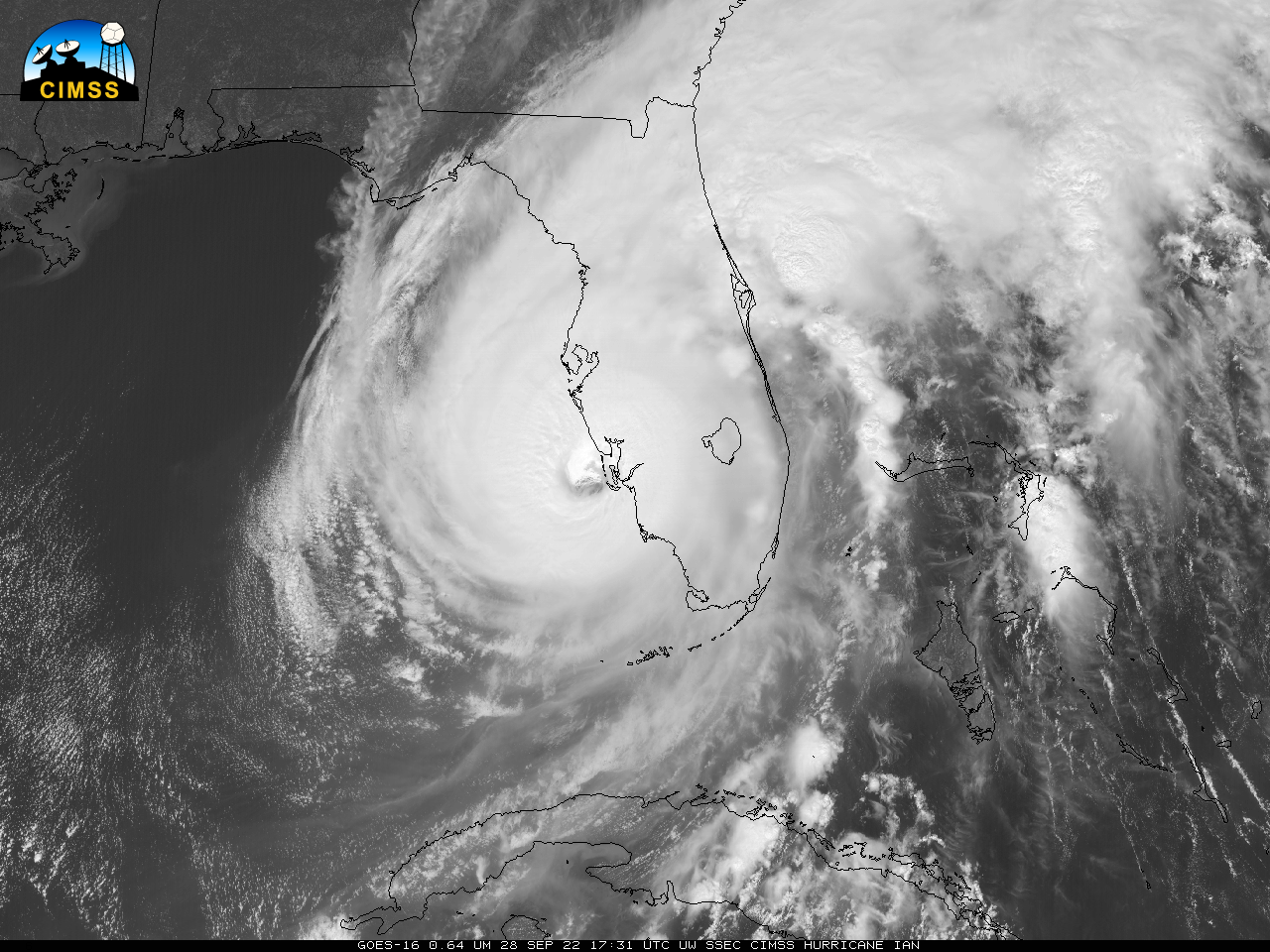
The toggle above compares eyewall sizes from 2004’s Hurricane Charley and 2022’s Hurricane Ian near landfall in/around Fort Myer FL. Charley was a small cat-4 storm at landfall (link) with a 10-nm wide eye.. Hurricane-force winds with Charley extended only 15-25 miles out from the eye (link). In contrast, Ian... Read More

30-second imagery of Hurricane Ian

Overlapping 1-minute Mesoscale Domain Sectors provided 30-second interval GOES-16 (GOES-East) “Red” Visible (0.64 µm) images, with and without an overlay of GLM Flash Extent Density (above) — which showed the well-defined eye of Category 3 Hurricane Ian as it moved away from the northern coast of Cuba on 27 September 2022. Near-continuous... Read More

Low-Earth Orbit satellite views of Ian as it formed, and comparisons to Geostationary imagery

Polar-orbiting satellites have microwave detectors that give important information about the low-level structure of an evolving tropical cyclone. If high clouds are omnipresent, it can be difficult for an analyst to diagnose storm strength with accuracy. Microwave energy penetrates clouds, however, and low-earth orbit (LEO) observations of microwave frequencies can... Read More