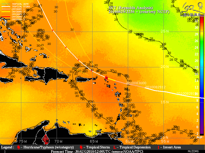
This website works best with a newer web browser such as Chrome, Firefox, Safari or Microsoft Edge. Internet Explorer is not supported by this website.

Category: GOES-15

Hurricane Earl

GOES-13 10.7 µm IR images (above) and 0.63 µm visible images (below) from the CIMSS Tropical Cyclones site showed Hurricane Earl after the storm reached Category 1 intensity on 29 August 2010. A Central Dense Overcast (CDO) could be seen developing in the images as Earl approached the Leeward Islands.A comparison of... Read More

The Active Tropical Atlantic

The infrared imagery from Friday morning, 27 August, shows three separate tropical systems — in various stages of development — over the Atlantic Ocean, with a fourth system poised to move out into the tropical Atlantic from Africa. Meteosat imagery shows a fifth system moving westward over central Africa (These images... Read More