Category: GOES-15
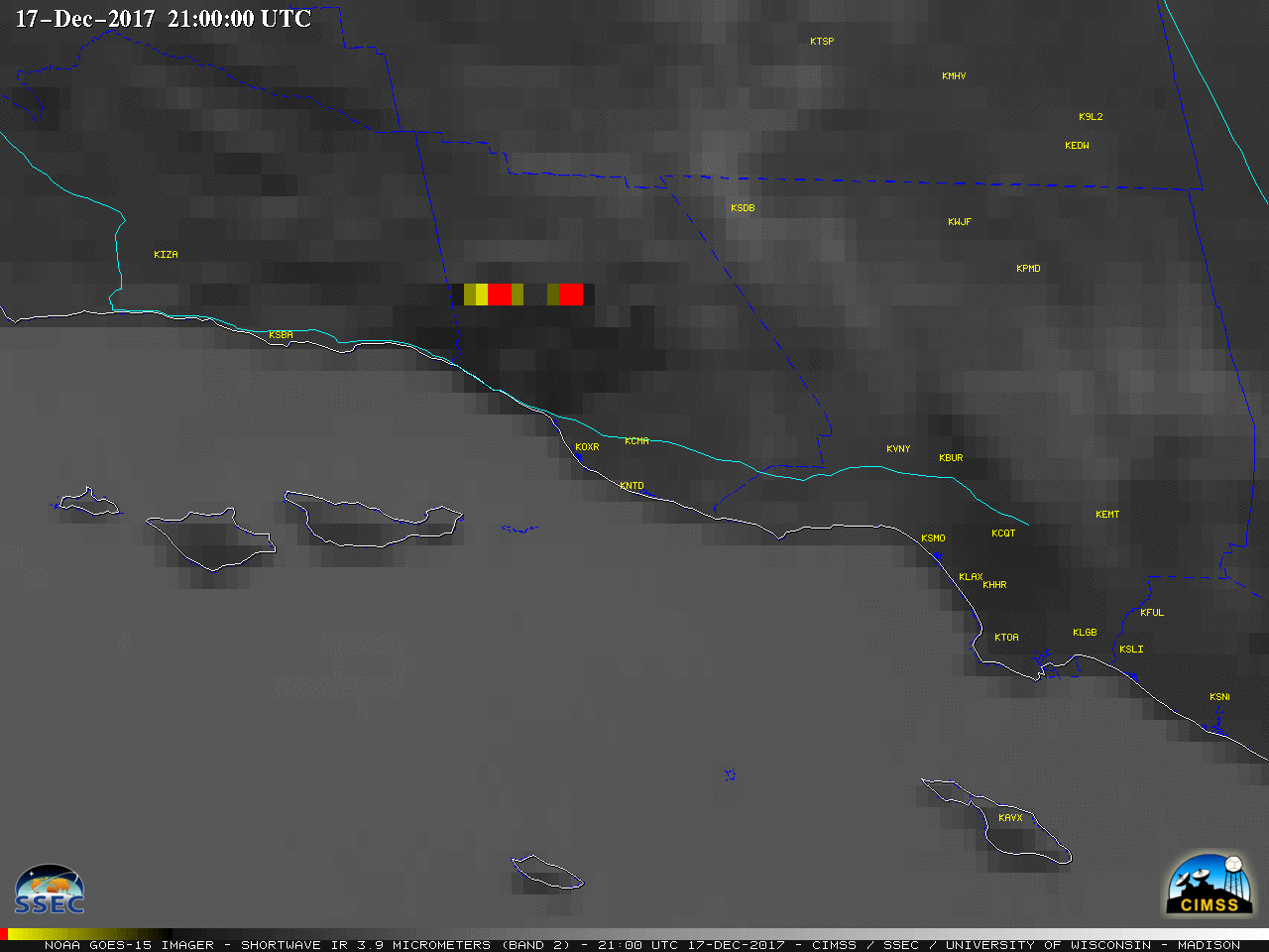
Day 7 of the Thomas Fire in Southern California
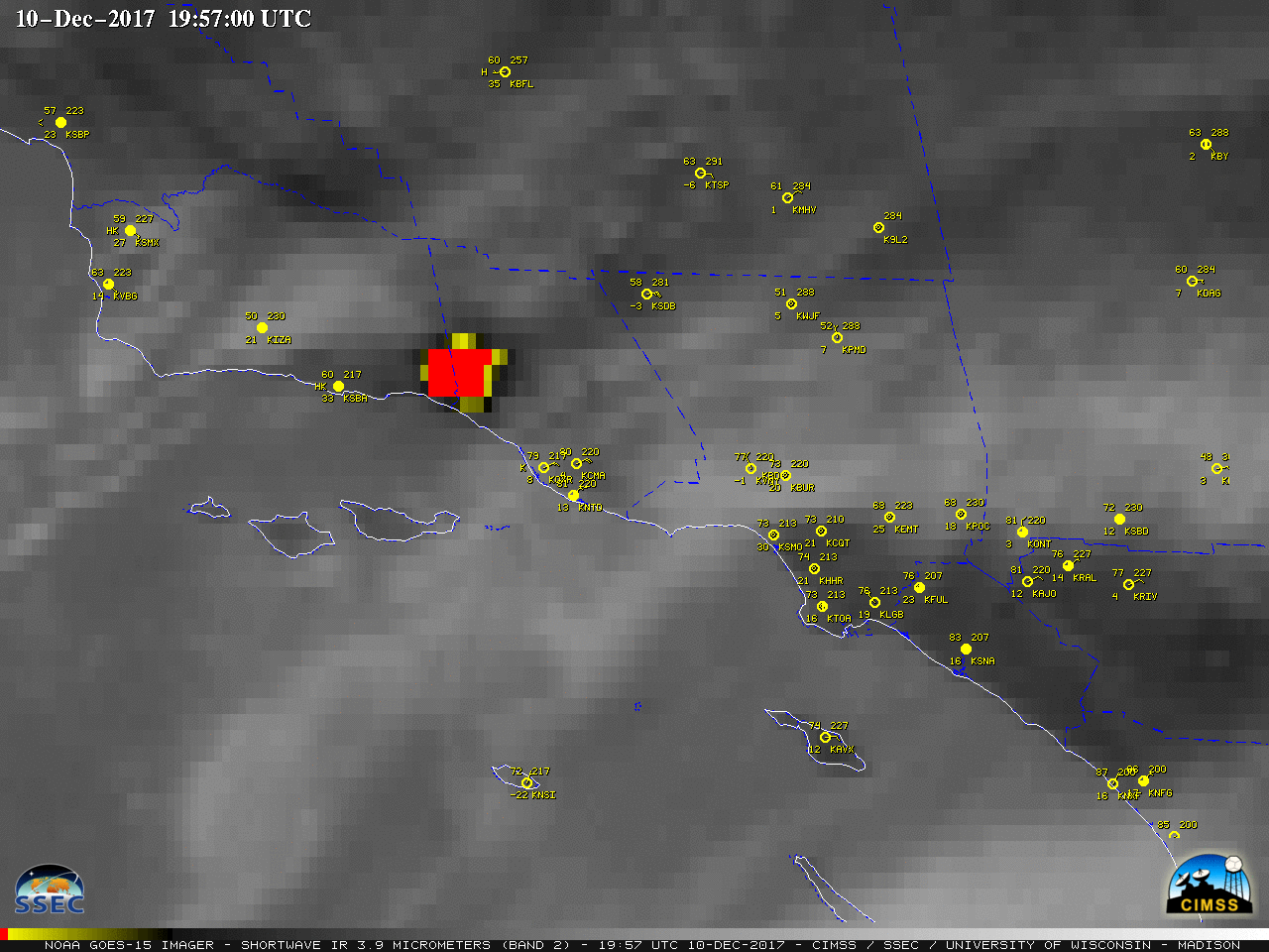
The Thomas fire began burning in Southern California around 6:30 PM local time on 04 December (blog post) — and on 10 December 2017, GOES-15 (GOES-West) Shortwave Infrared (3.9 µm) images (above) revealed that the fire showed little signs of diminishing during the nighttime hours, and in fact began to exhibit a trend of... Read More
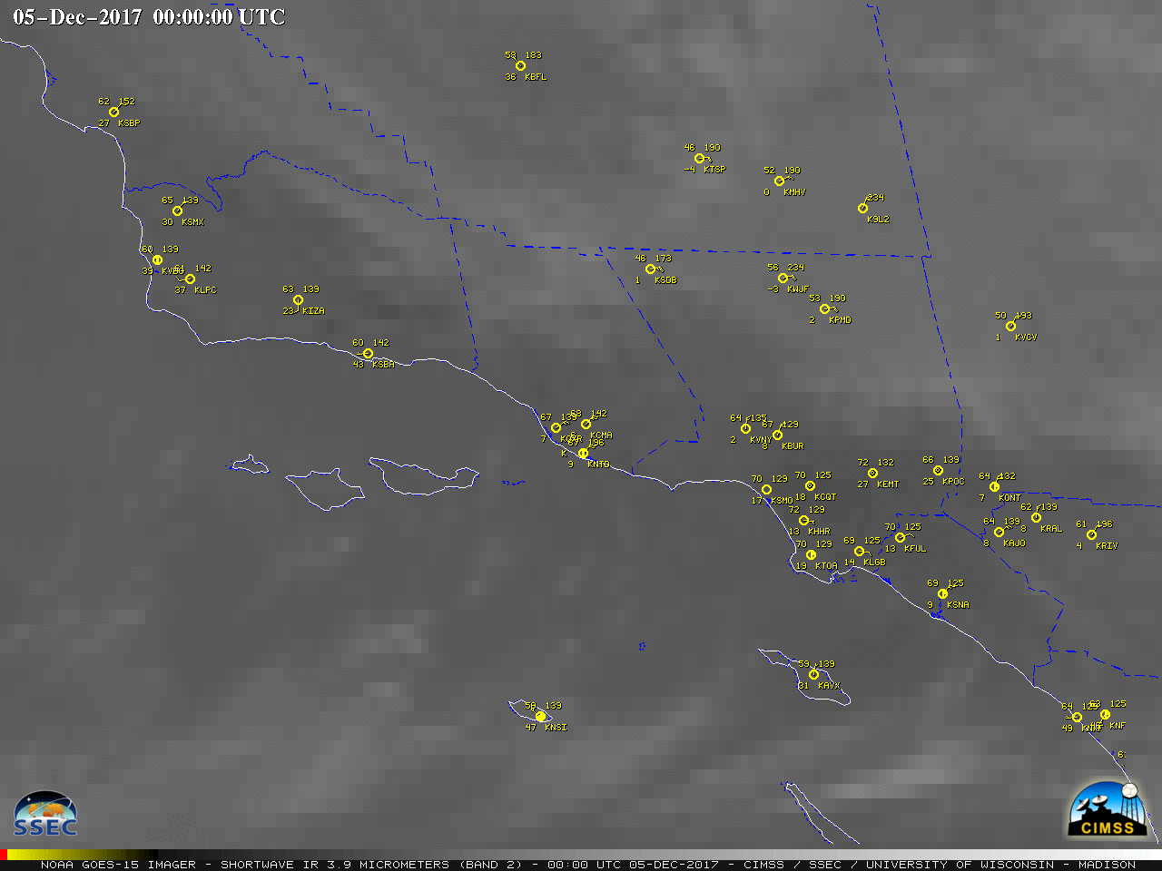
Wildfires in southern California
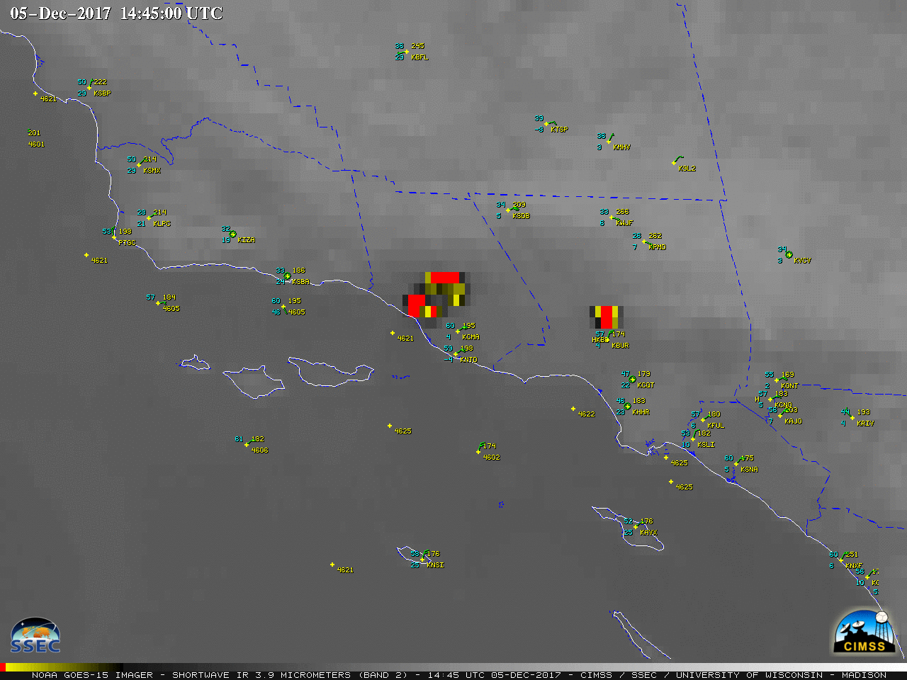
GOES-15 (GOES-West) Shortwave Infrared (3.9 µm) images (above; also available as an animated GIF) showed the rapid development of wildfires driven by strong Santa Ana winds in Southern California on 05 December 2017. The fire thermal anomalies or “hot spots” are highlighted by the dark black to yellow to red pixels — the initial signature... Read More
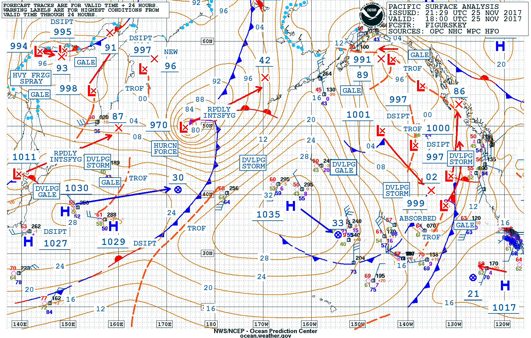
Strong storm in the Bering Sea
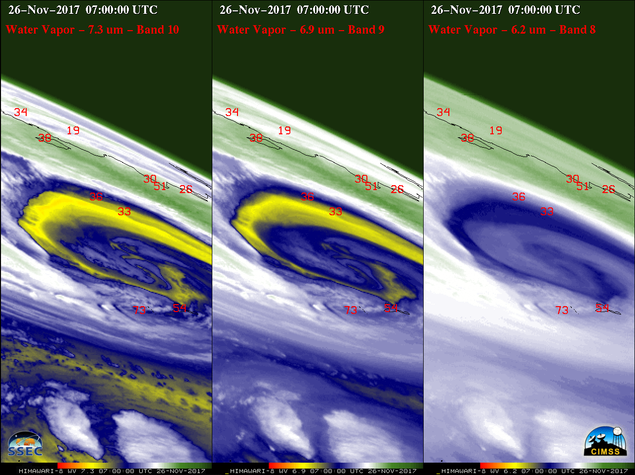
Himawari-8 Lower-level (7.3 µm), Mid-level (6.9 µm) and Upper-level (6.2 µm) Water Vapor images (above) showed a strong storm as it was rapidly intensifying south of the Aleutian Islands and moving into the Bering Sea during the 25-26 November 2017 period (surface analyses), producing hurricane force winds. Hourly surface wind gusts... Read More
