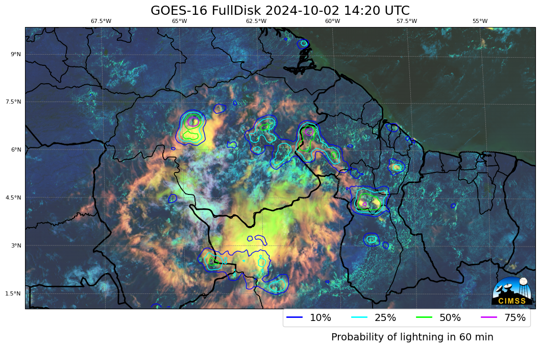
This website works best with a newer web browser such as Chrome, Firefox, Safari or Microsoft Edge. Internet Explorer is not supported by this website.

Category: GLM

Hurricane Otis rapidly intensifies to Category 5, just prior to making landfall near Acapulco, Mexico

1-minute Mesoscale Domain Sector GOES-18 (GOES-West) “Clean” Infrared Window (10.3 µm) images (above) showed Hurricane Otis as it approached the coast of Mexico, making landfall near Acapulco (Acapulco International Airport, METAR identifier MMAA, is located about 16 miles southeast of the city center) around 0625 UTC on 25 October 2023. During the 11-hour time period shown,... Read More

Lake effect rain downwind of Lake Erie and Lake Ontario

5-minute GOES-16 (GOES-East) Day Cloud Phase Distinction RGB images with overlays of GLM Flash Extent Density, LightningCast Probability and Buoy/METAR reports (above) showed glaciating (brighter shades of green) and glaciated (pale shades of yellow) cloud bands streaming eastward and southeastward off Lake Ontario and Lake Erie on 08 October 2023. Some of these cloud bands were producing lake effect... Read More

LightningCast probabilities in the cool season

Seasonably cool Fall-like temperatures overspread the western Great Lakes and northern Plains on 5 October. The animation above shows the Day Cloud Phase Distinction overlain with LightningCast probability from 1321-1721 UTC on 5 October (that is, 8:21-12:21 CDT). SPC on this day was anticipating general thunder over northern Minnesota. Given that,... Read More