This website works best with a newer web browser such as Chrome, Firefox, Safari or Microsoft Edge. Internet Explorer is not supported by this website.

Category: Geo2Grid

Brief flareup of the Moose Fire in Idaho

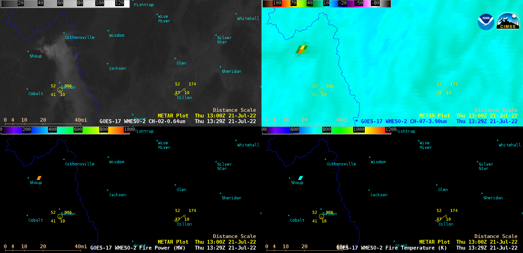
1-minute Mesoscale Domain Sector GOES-17 (GOES-West) “Red” Visible (0.64 µm), Shortwave Infrared (3.9 µm), Fire Power and Fire Temperature images (above) showed an unusual early-morning flareup of the Moose Fire in Idaho on 21 July 2022. The Fire Temperature and Fire Power derived products are components of the GOES Fire Detection and Characterization... Read More

Alaskan wildfire smoke

GOES-18 images in this blog post are preliminary and non-operational GOES-18 True Color RGB images created using Geo2Grid (above) showed smoke from Alaskan wildfires that had been transported southward over Kodiak Island and the northern Gulf of Alaska. Most of this smoke remained aloft — note that although Kodiak began... Read More