This website works best with a newer web browser such as Chrome, Firefox, Safari or Microsoft Edge. Internet Explorer is not supported by this website.

Category: General interpretation

The Active Tropical Atlantic

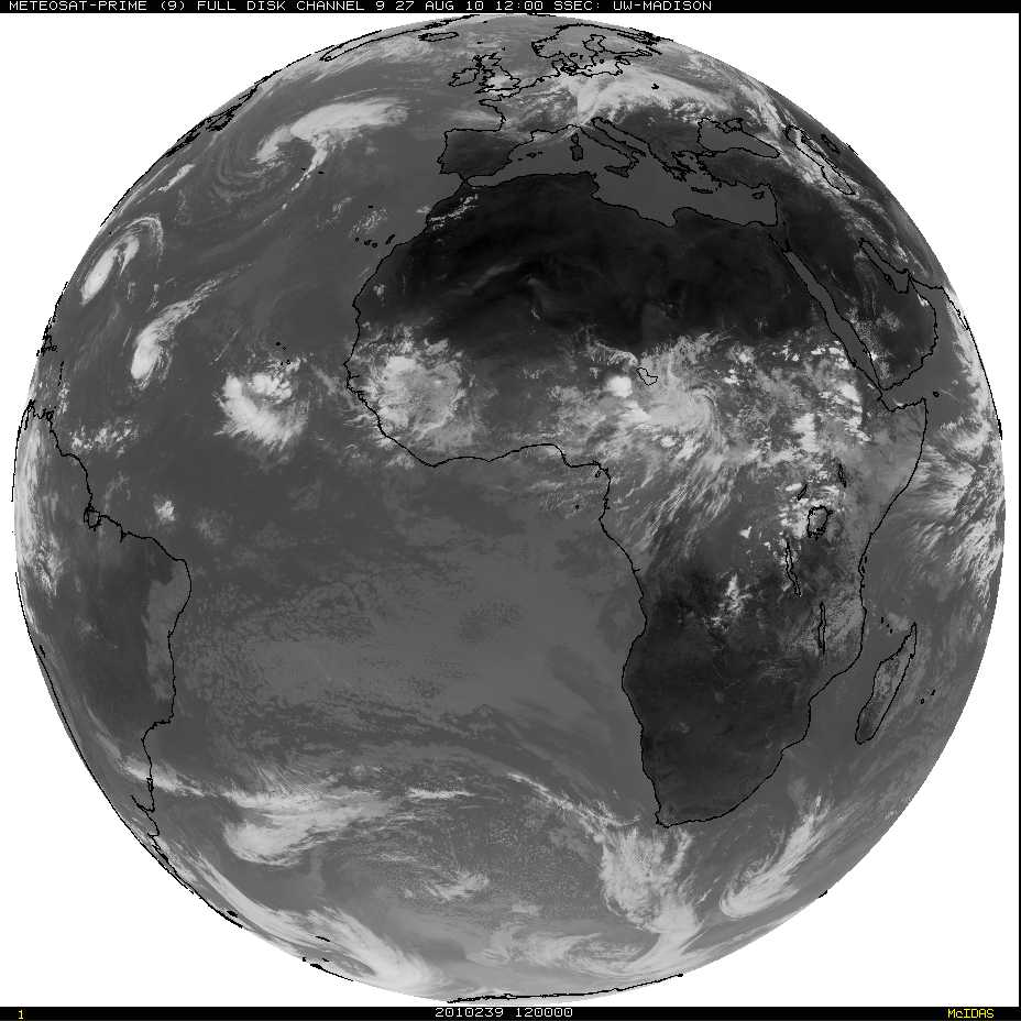
The infrared imagery from Friday morning, 27 August, shows three separate tropical systems — in various stages of development — over the Atlantic Ocean, with a fourth system poised to move out into the tropical Atlantic from Africa. Meteosat imagery shows a fifth system moving westward over central Africa (These images... Read More

Long-lived low cloud edge over the Eastern Pacific Ocean

Visible and infrared GOES-11 imagery over the eastern Pacific Ocean have indicated a persistent southwestward-moving cloud edge during the past several days. The visible image, above, from 1830 UTC on 25 August, shows a distinct cloud edge arcing from northwest to southeast. What is the history of this feature? The... Read More

Warm Water in the Great Lakes

Recent news articles (such as this one) have noted the unusual warmth present in the surface waters of the Great Lakes. Clear skies over the western Great Lakes on Sunday 8 August allowed MODIS instruments to measure sea surface temperatures, and the warm temperatures are plain to see. These warm temperatures... Read More