Tropical Storm Alberto in the southern Gulf of Mexico
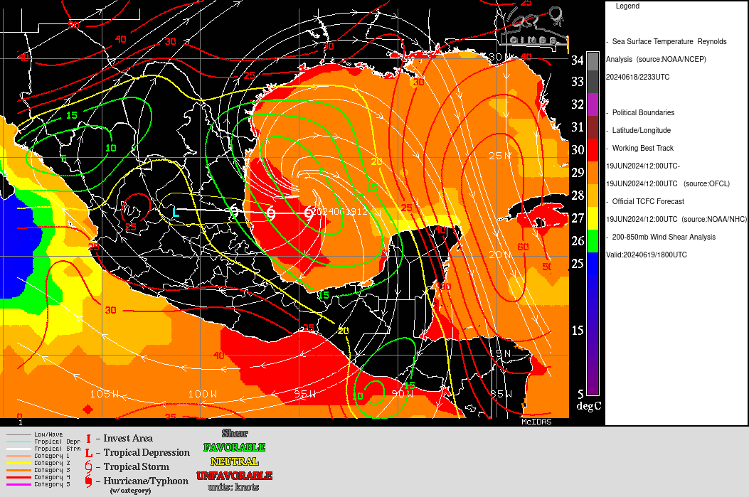
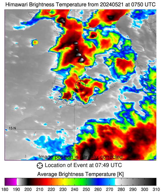
MIMIC Total Precipitable Water fields from 15 June through 19 June 2024, above, show a broad cyclonic circulation over Central America and adjacent waters (the Central American Gyre). On 18 June, shown below in an animation from the CSPP Geosphere site, the convection in this gyre was diffuse and unorganized (although the... Read More
