NOAA/CIMSS ProbTor with a Severe Thunderstorm over Florida
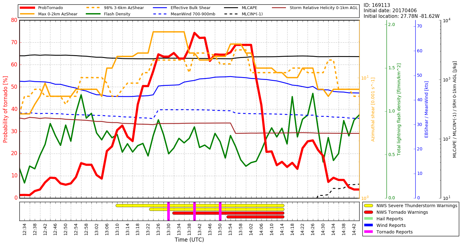
GOES-16 data posted on this page are preliminary, non-operational data and are undergoing testing.GOES-16 Visible Imagery early on 6 April 2017 showed a strong thunderstorm developing north of Lake Okeechobee and proceeding east towards the Atlantic Coast near Vero Beach (1-minute or 30-second imagery was not available over Florida because... Read More
