Severe Weather over the southern United States
GOES-16 data posted on this page are preliminary, non-operational data and are undergoing testing.
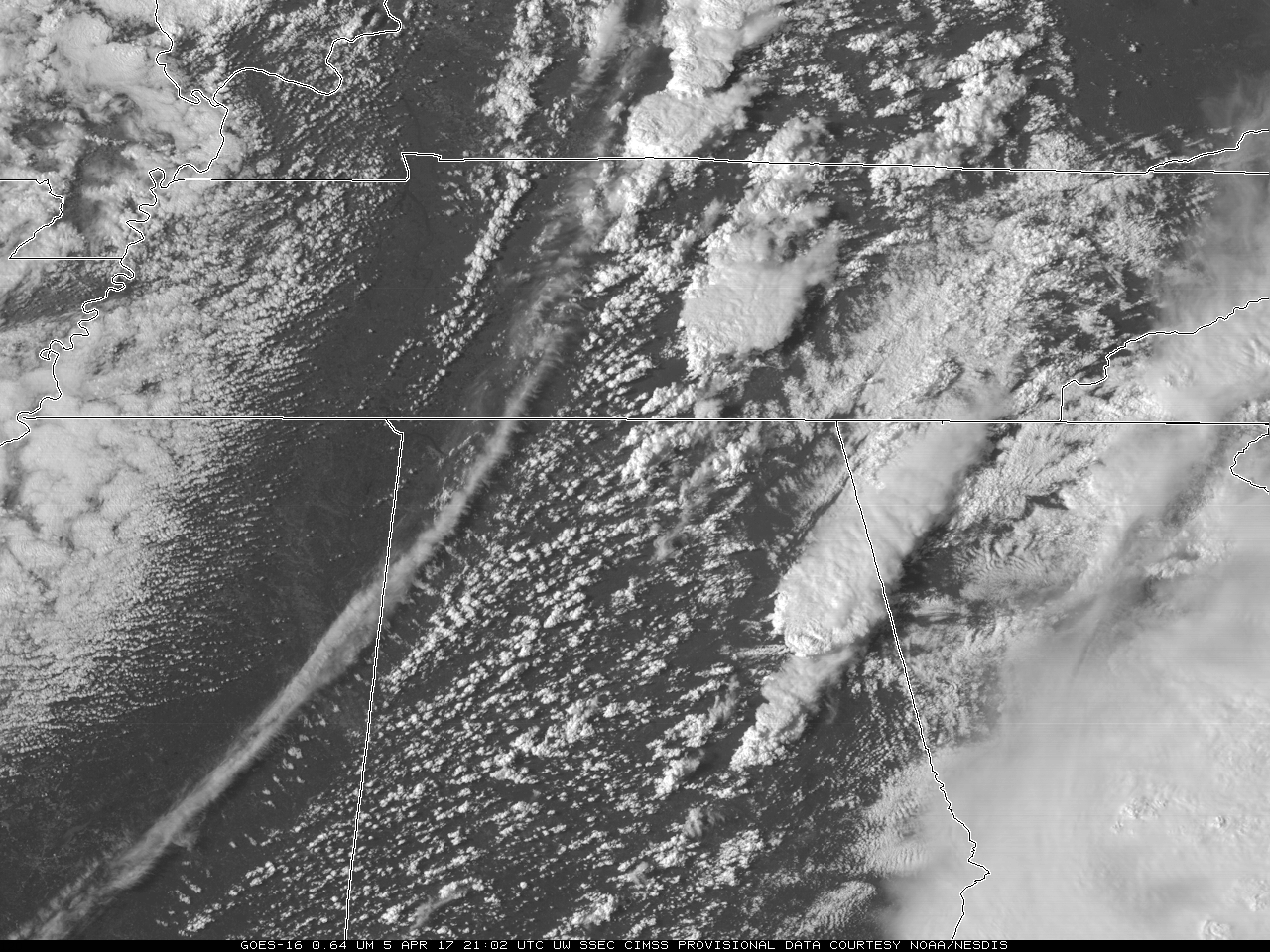
On 5 April 2017, The Storm Prediction Center in Norman OK issued a Day 1 Convective Outlook that included Moderate and High Risk areas over much of the southeastern United States. Mesoscale discussion 442 and 448 on 5 April discuss the area shown above. One of two GOES-16 Mesoscale Sectors on 5 April viewed this scene, and a 2-hour animation spanning the outbreak of convection is shown above. It is difficult to predict which particular towering cumulus is going to grow into a cumulonimbus based on the visible imagery alone.

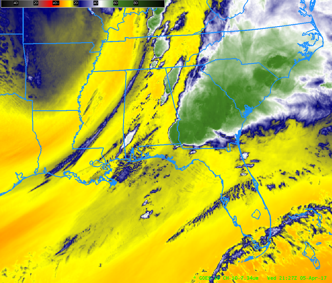
GOES-16 Low-Level Water Vapor Band (7.34 µm) from 2002 through 2127 UTC on 5 April 2017 (Click to animate)
Water Vapor Imagery from GOES-16 might help in that prediction. The animation above, from 2000 UTC to 2130 UTC, shows multiple subtle gradients in the low-level water vapor field that could be associated with impulses influencing convective initiation. Convection appears to form along those subtle gradients. The 16 channels on ABI offer far more information than legacy GOES.
=========================================================
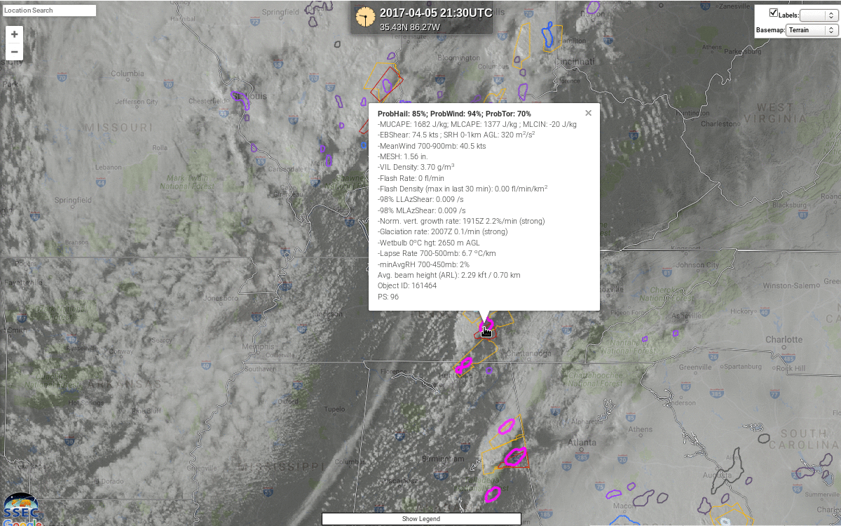
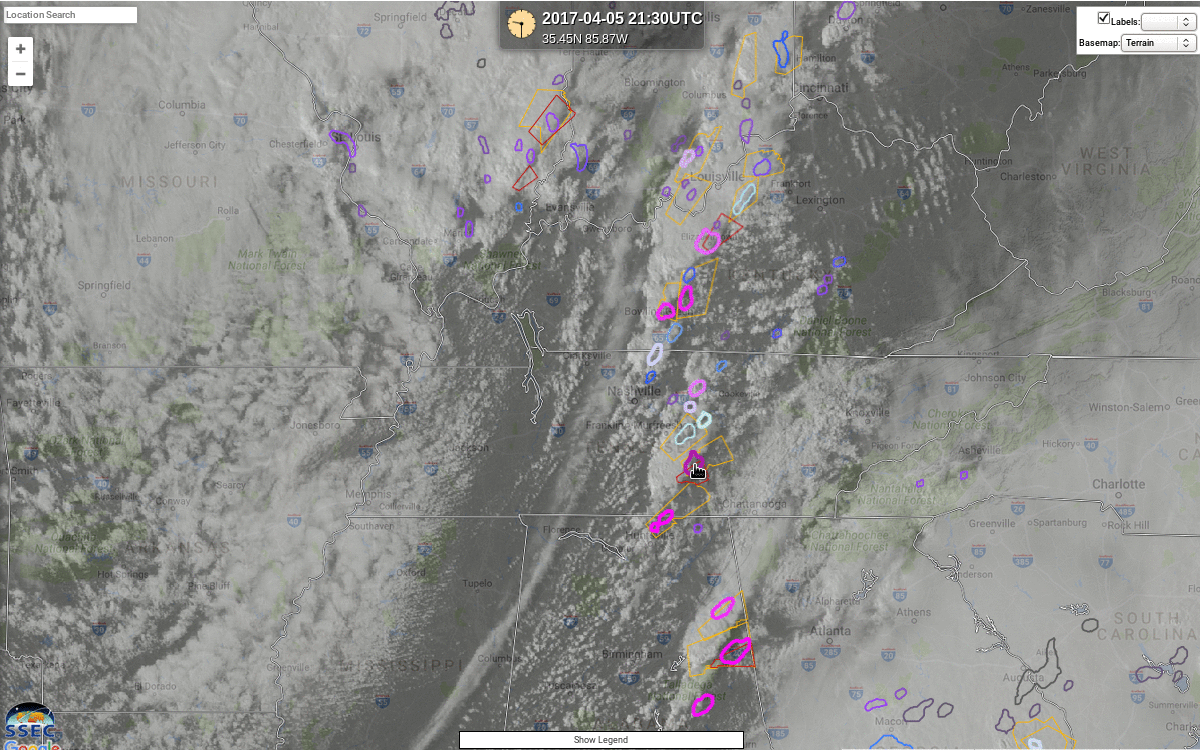
CIMSS Scientists have been refining the NOAA/CIMSS ProbSevere product to account for individual threats (Hail, Wind, Tornado), and a screen capture of that product is shown below. Radar Objects are outlined in colors that relate to the Probability of a severe event. These outlines allow a forecaster to determine which cell is potentially most threatening based on the inputs into the determination of probability.
At 2130 UTC, shown above, a cell over Tennessee has the highest ProbTor probability; the readout (below) shows the variables that are used in computing all the hazard probabilities — ProbHail, ProbWind, and ProbTor (Not all variables are used for all products; for example, ProbTor does not use Satellite-derived growth rates; ‘PS‘ in the output is the value of the 2016 version of ProbSevere). ProbTor of 70% for the cell over Tennessee (compared to smaller values at nearby cells) suggests that particular cell deserves special attention from anyone monitoring the cell for development. The ProbTor for the warned cell in Alabama — a cell that produced Tennis Ball-sized hail near Heflin , showed a ProbTor value at this time of 43% — a larger value than for the storms on either side of it — again suggestive that it should be of most concern. Ten minutes later, at 2140 UTC, ProbTor for the Tennessee storm had dropped to 34%, and that of the Alabama storm had increased to 55%.
ProbTor will be one of the CIMSS products demonstrated at the Hazardous Weather Testbed in June and July this year.

NOAA/CIMSS ProbSevere for All Hazards at 2130 UTC on 5 April; The readout for the indicated cell is shown (Click to enlarge)
Note: ProbSevere products are computed using legacy GOES imagery only. GOES-16 data can be incorporated into this tool only after the statistical model has been trained on GOES-16 data, and that has not yet happened; A GOES-16 version is planned for the 2018 convective season.


