Severe thunderstorms in North Dakota
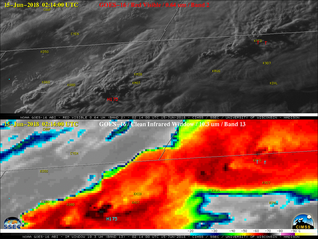
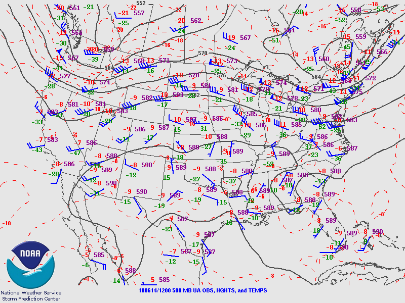
GOES-16 (GOES-East) Mid-level Water Vapor (6.9 µm) images (above) revealed the circulation of a shortwave aloft (500 hPa analyses) that was moving from the northern Rockies to the southern Canadian Prairie Provinces on 14 June 2018. The approach of this shortwave was helping to enhance large-scale forcing for ascent, as an occluded surface low developed... Read More
