Camp Fire in northern California
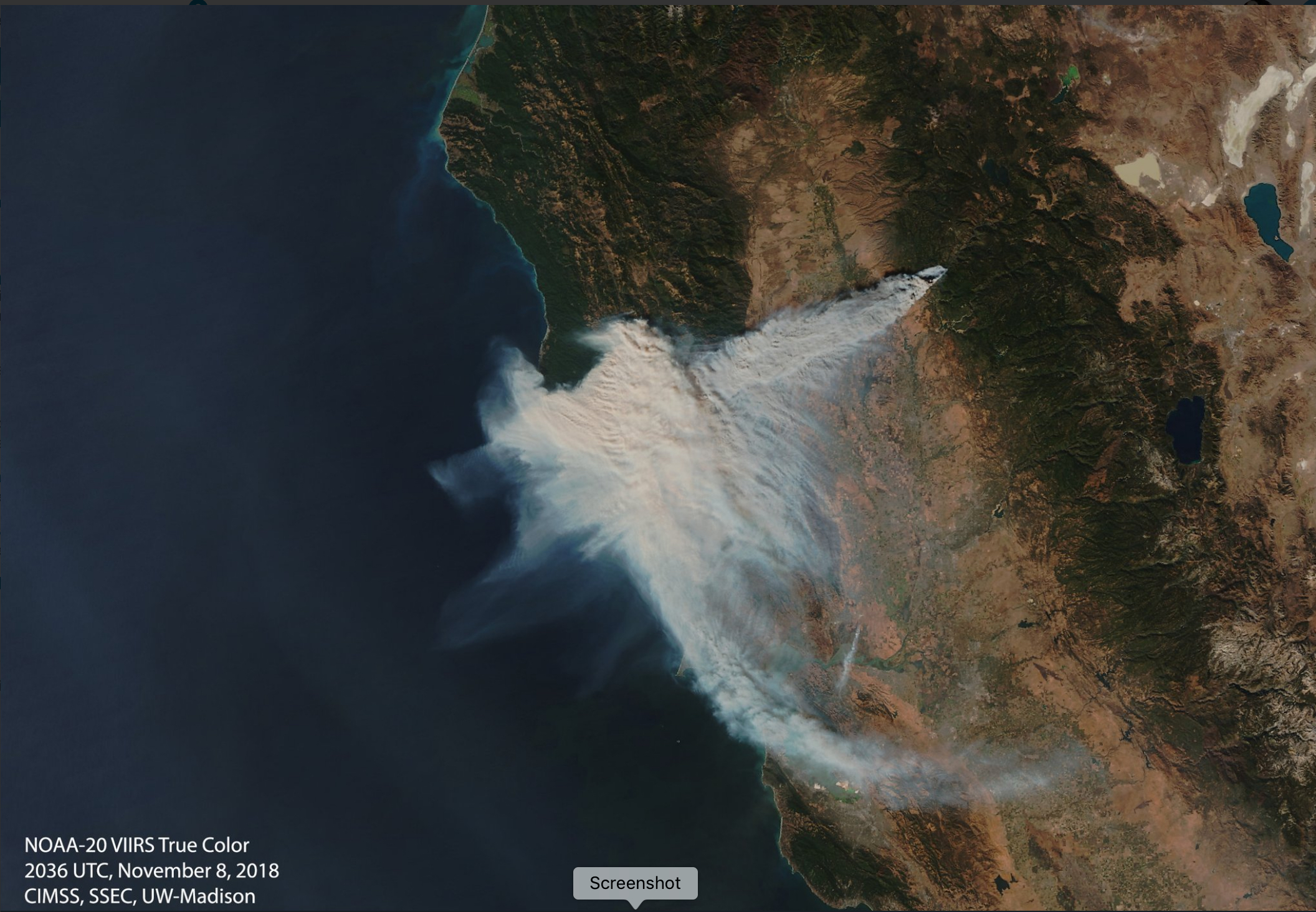
The Camp Fire started around 1433 UTC or 6:33 AM local time on 08 November 2018 in Northern California; the rapid spread of the fire prompted evacuations and forced road closures. GOES-16 (GOES-East) GOES-16 “Red” Visible (0.64 µm), Shortwave Infrared (3.9 µm), “Clean” Infrared Window (10.3 µm) and Fire Temperature (above) showed the initial evolution of the... Read More