This website works best with a newer web browser such as Chrome, Firefox, Safari or Microsoft Edge. Internet Explorer is not supported by this website.

Stories by Scott Bachmeier

Heavy rainfall across Interior Alaska

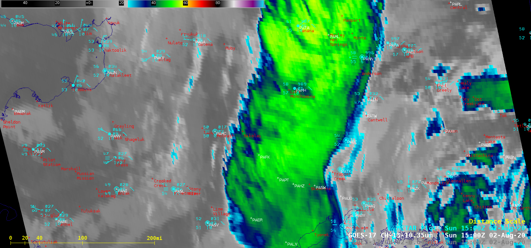
An animation of Topography + GOES-17 (GOES-West) “Clean” Infrared Window (10.35 µm) images (above) showed a southward-moving band of clouds responsible for producing heavy rainfall across portions of Interior Alaska on 02 August 2020. Cloud-top infrared brightness temperatures were as cold as -58ºC (brighter shades of yellow).GOES-17 “Red” Visible (0.64 µm) images... Read More

Potential Tropical Cyclone 9 intensifies to become Tropical Storm Isaias

1-minute Mesoscale Domain Sector GOES-16 (GOES-East) “Red” Visible (0.64 µm) and “Clean” Infrared Window (10.35 µm) images (above) showed Potential Tropical Cyclone Nine as it moved northwestward across the Caribbean Sea on 29 July 2020. In Puerto Rico, Luis Muñoz Marin Airport in San Juan (TJSJ) had a wind gust to 44 knots (51 mph) around 19 UTC. Numerous pulsing... Read More