Fog and Low Cloud Detection

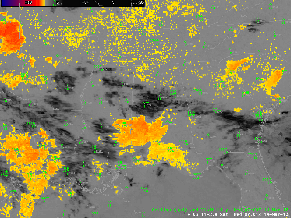
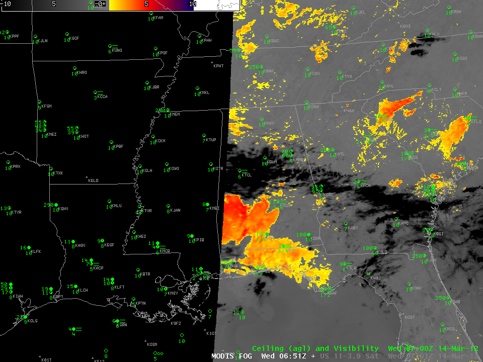
Regular readers of this blog will be quick to recognize the GOES imagery above as a low cloud detection product that exploits the differences in emissivity properties for water droplets that exist between 3.9 and 10.7 µm, two radiation bands that are detected on the GOES imager. The emissivity differences mean that 10.7 µm brightness temperatures will be warmer than 3.9 µm brightness temperatures, so a difference field will highlight where low clouds exist. This can be done with GOES imagery, above, or with MODIS imagery, below. Note that the existence of the low cloud may or may not suggest fog: only the top of the cloud is detected; whether or not the cloud rests on the ground cannot be determined easily from satellite.

Both the GOES and MODIS imagery show slow expansion to the low cloud field over the 3 hours, as might be expected given slow cooling at night. However, careful inspection reveals a variety of regions that show obstructions to visibility but no indication of fog or low clouds. For example, Montgomery (KMGM), Mobile (KMOB) and Tuscaloosa (KTCL) all show fog observations in the absence of a clear signal of detected low cloud. Similar observations occur over eastern Georgia and the Carolinas.

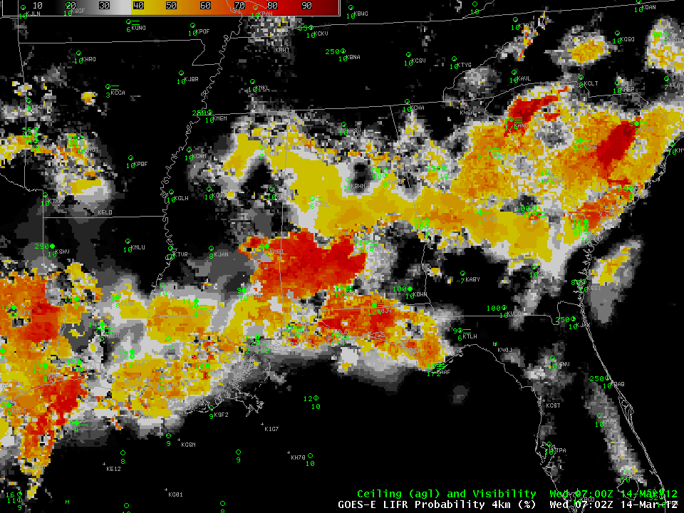
New low-cloud detection algorithms that incorporate model information (from the RUC, or, in the near future, the Rapid Refresh) can quantitatively describe the evolution of the low cloud and fog field. These algorithms were initially developed (and trained) using GOES data and are distributed to the AWIPS environment here at CIMSS. The loop above shows probabilities of Low IFR visibilites over the deep south during the morning. (Click for the 0400 UTC and 0700 UTC examples). Because the GOES-R product synthesizes model and satellite data together, better fog/low cloud detection occurs in regions where high clouds make low cloud detection difficult. Note how the probability of a visibility obstruction increases during the course of the night, and how places that develop fog are among the first to see a LIFR signal.
The visible imagery from GOES-13, below, shows the characteristic erosion of the low clouds, from outside in, during the course of the subsequent day. As usually happens, cumulus development is suppressed in regions where low clouds persist during the morning.

