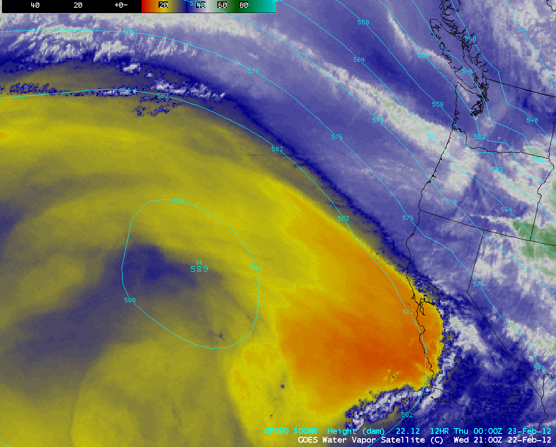
Strong subsidence signal on water vapor imagery
AWIPS images of GOES-15 6.5 µm water vapor channel data (above; click image to play animation) displayed a signal of strong subsidence around the eastern periphery of a middle-tropospheric ridge of high pressure located over the eastern North Pacific Ocean on 22 February 2012. Note the rapid warming of water vapor brightness temperatures just off the coast of California, reaching abnormally high values of 14º C (darker orange color enhancement) by 21:00 UTC. This rapid middle-tropospheric drying created the appearance of a very strong moisture gradient on the water vapor imagery, being adjacent to the clouds and higher levels of moisture associated with the polar jet stream that was moving southeastward across the Pacific Northwest region of the US.
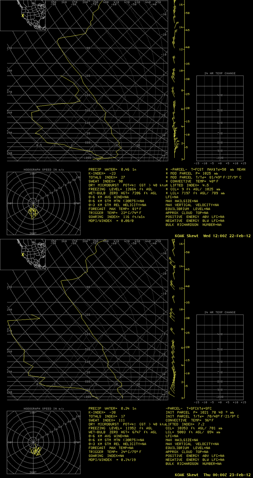
The magnitude of the dry air within the middle to upper troposphere was very apparent on rawinsonde data from Oakland, California (below).


