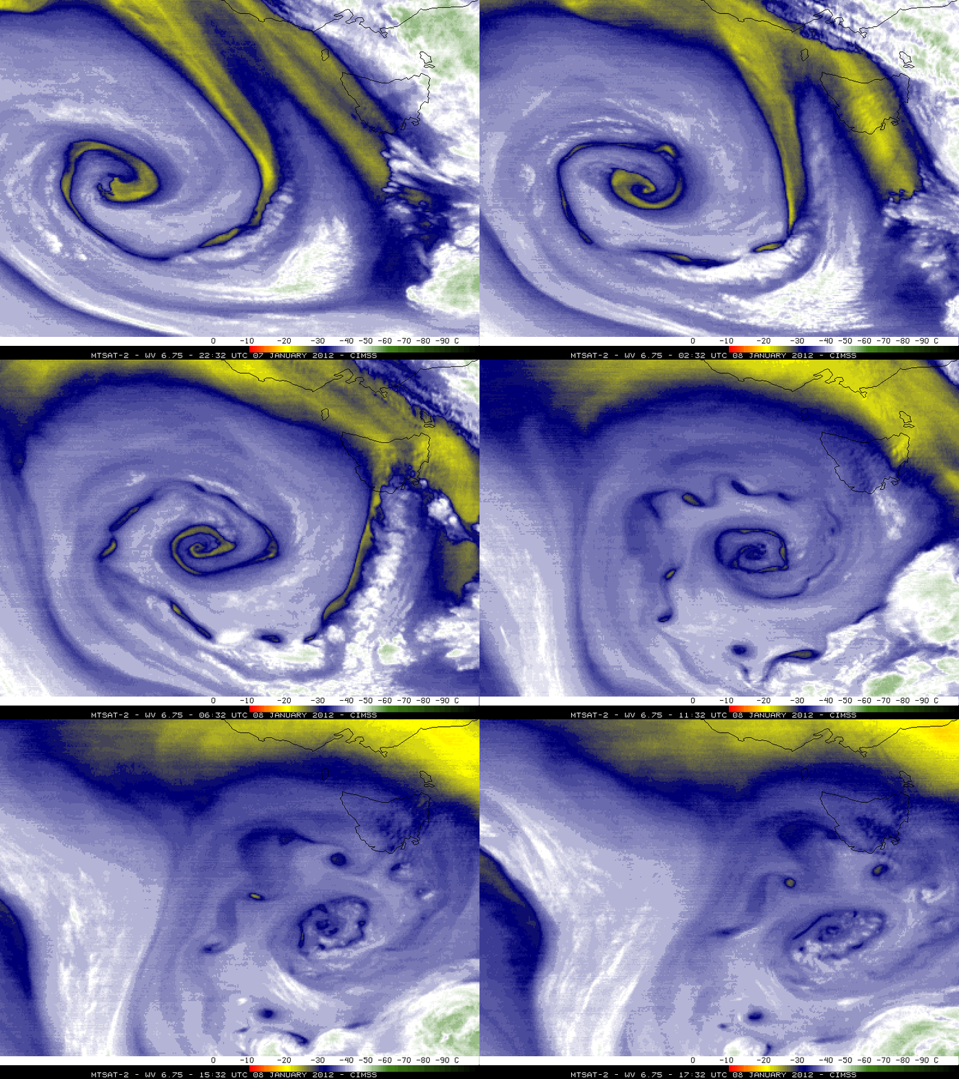
Occluding cyclone south of Australia
A large area of low pressure over the Southern Ocean between Australia and Antarctica on 07 January – 08 January 2012 (surface analyses) exhibited a beautiful signature of an occluding cyclone on 5-km ressolution MTSAT-2 6.75 µm water vapor channel imagery (above; click image to play animation). This storm prompted the issuance of Gale Warnings for widespread areas of winds of 30-45 knots producing high seas.
A closer view of the MTSAT-2 water vapor imagery (below) revealed very intricate detail to the plume of dry air wrapping into the ceter of the storm, along with several small vortices of dry air that became cut off and isolated along the periphery of the system as it began to decay just southwest of the island of Tasmania.


