GOES-15: Full Disk images every 30 minutes
The normal operational GOES scanning schedule provides one complete Full Disk image every 3 hours (at 00 UTC, 03 UTC, 06 UTC, etc). However, as part of the final testing of GOES-15 the satellite was placed into a mode that provided one Full Disk scan every 30 minutes for a 24-hour period from 30 November – 01 December 2011 (above; click image to play animation). Note that some of the warmest/driest air seen across the Western Hemisphere during that time (darker orange color enhancement) was surging southward over California, a signal of strong subsidence within the middle troposphere associated with a developing high wind event across the western US.
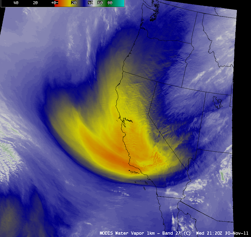
An AWIPS image of 1-km resolution MODIS 6.7 µm water vapor channel data (below) provided a more detailed view of the pocket of middle tropospheric dry air at 21:20 UTC on 30 November 2011. Note the intricate wave structure seen on the image, a result of the strong winds interacting with the terrain of the region.


