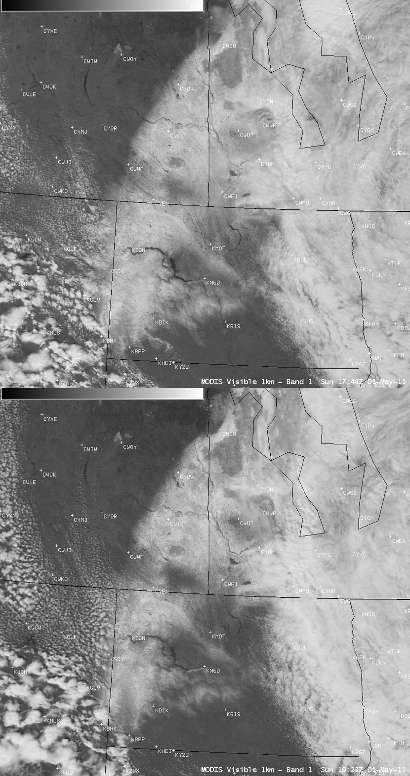
Post-blizzard snow cover in North Dakota and southern Canada
A late-season blizzard produced as much as 14.0 inches of snowfall with winds gusting as high as 78 mph across western North Dakota (and 10.0 inches of snowfall across extreme eastern Montana) on 30 April 2011, causing power outages and the closure of Interstate 94 from Dickinson to the Montana border. On the following day (01 May 2011), AWIPS images of MODIS 0.65 µm visible channel data (above) displayed a mixture of fresh snow cover and cloudiness across parts of western North Dakota, far southeastern Saskatchewan, and southwestern Manitoba. However, in some areas it was difficult to visually separate the cloud features from the snow cover (although the edges of the snow pack that were quickly melting within the 102-minute time period between the 2 MODIS images were fairly obvious).
The corresponding pair of MODIS false color Red/Green/Blue (RGB) images (below) — created using MODIS bands 01/07/07 — allowed for the unambiguous discrimination between the fresh snow cover (which appeared darker red) and the various cloud features (supercooled water droplet clouds exhibited a much brighter appearance, while glaciated ice crystal clouds appeared as varying shades of pink). As much as 7 inches of snow remained on the ground that morning at Williston in northwestern North Dakota (station identifier KISN) as well as at a couple of stations in southwestern Manitoba. Also note that along the Missouri River there is a significant amount of ice remaining on much of the eastern half of Lake Sakakawea in the vicinity of Garrison, North Dakota (station identifier KN60).
CIMSS participation in GOES-R Proving Ground activities includes making a variety of MODIS images and products available for National Weather Service offices to add to their local AWIPS workstations.


