Wisconsin: 8 consecutive days with the coldest overnight low temperatures in the Lower 48 states
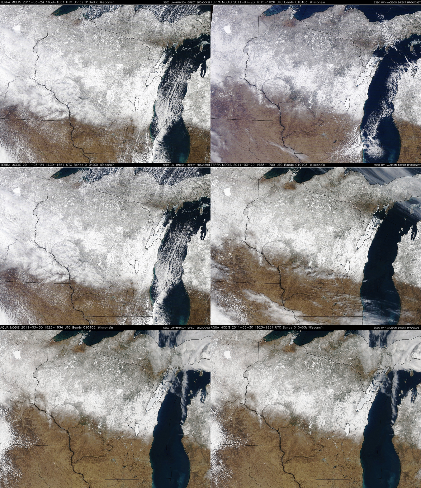
A series of MODIS true color Red/Green/Blue (RGB) images from 24 March, 27 March, 28 March, 29 March, and 30 March (above) showed that most of the northern 2/3 of Wisconsin had significant snow cover during this period (much of it due to the late winter storm of 22-23 March) — the maximum snow depths across the state ranged from 24 inches on 24 March to 18 inches on 30 March. Also note that there were also a few small brown-colored areas in far northwestern Wisconsin with no snow on the ground at this time.
This combination of deep snow late-season cover along with cloud-free skies due to persistent high pressure over the region allowed northern Wisconsin to record the coldest overnight low temperatures in Lower 48 states for 8 consecutive days at the end of March 2011:
- 24 March: -8ºF at Hayward
- 25 March: -12ºF at Tomahawk
- 26 March: -13ºF at Tomahawk
- 27 March: -12ºF at Tomahawk
- 28 March: -13º F at Tomahawk
- 29 March: -7ºF at Tomahawk
- 30 March: +1ºF at Tomahawk
- 31 March: +7ºF at Antigo
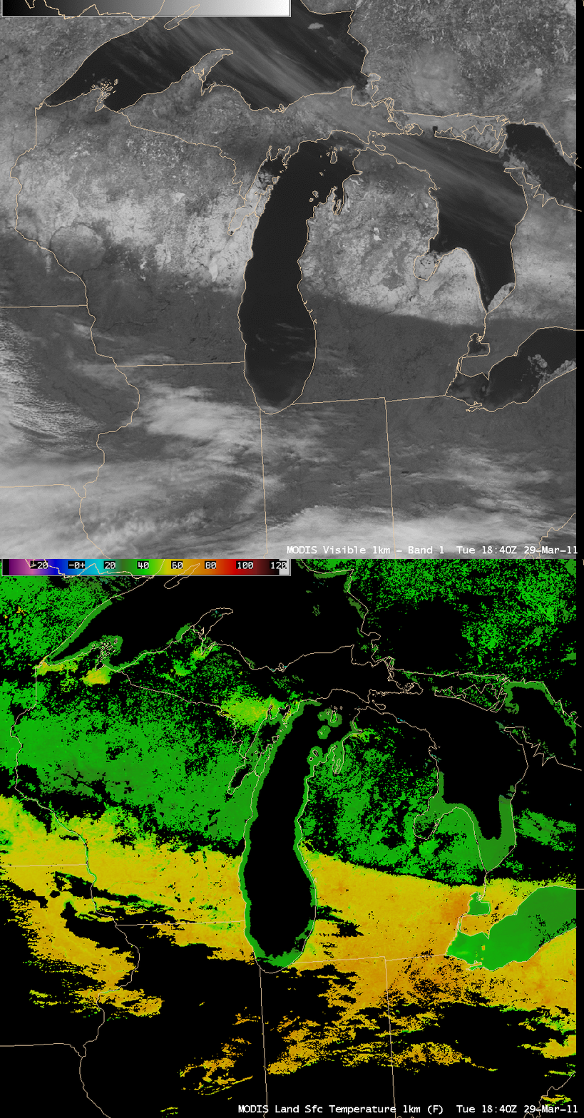
A comparison of AWIPS images of the MODIS 0.65 µm visible channel and the corresponding MODIS Land Surface temperature (LST) product (below) showed the effect that the deep snow cover was having across Wisconsin and Lower Michigan on 29 March. MODIS LST values ranged from the upper 20s to middle 30s F (green color enhancement) over the snow covered areas to the upper 60s to low 70s F (darker orange color enhancement) just to the south


