Snow cover in northern Wisconsin
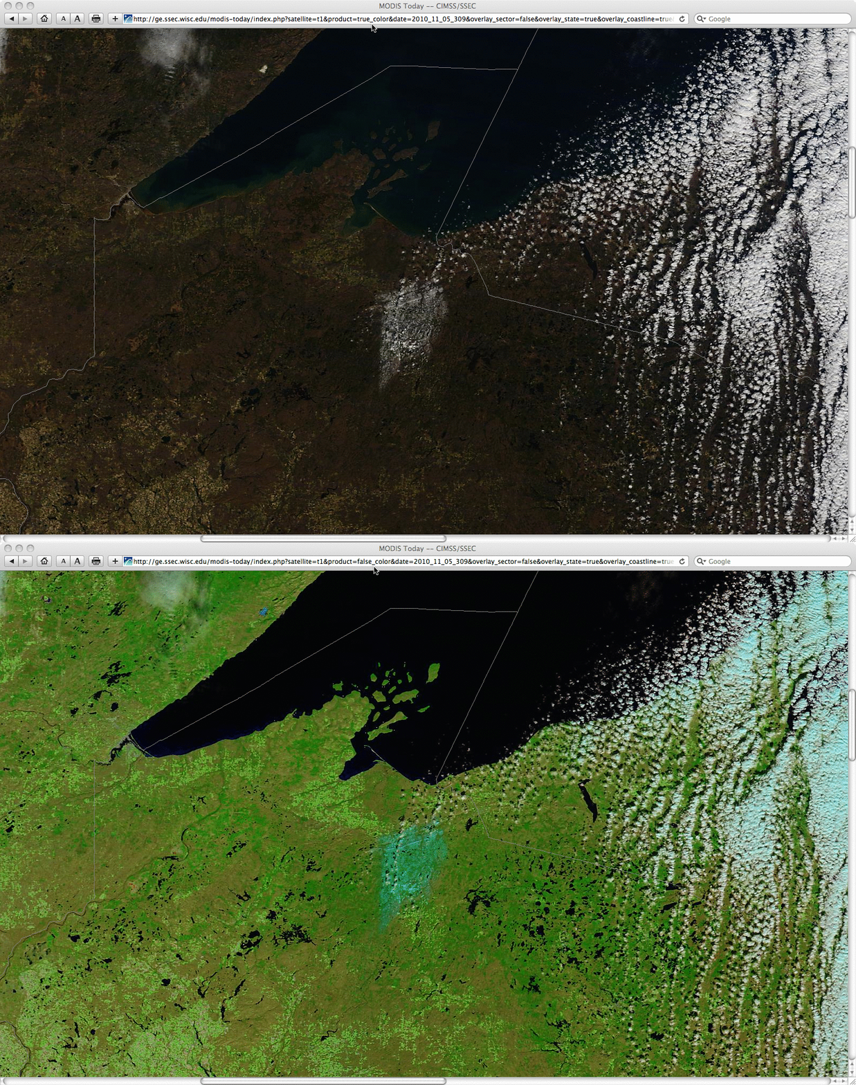
A comparison of a 250-meter resolution MODIS true color Red/Green/Blue (RGB) image (created using Bands 1/4/3) with the corresponding MODIS false color image (created using Bands 7/2/1) obtained from the SSEC MODIS Today site confirmed that the brighter white area seen in far north-central Wisconsin on 05 November 2010 was a patch of snow that remained on the ground following a period of lake-effect snow 1-2 days earlier. Snow cover and/or ice appears as cyan-colored features in the MODIS 7/2/1 RGB false color image.
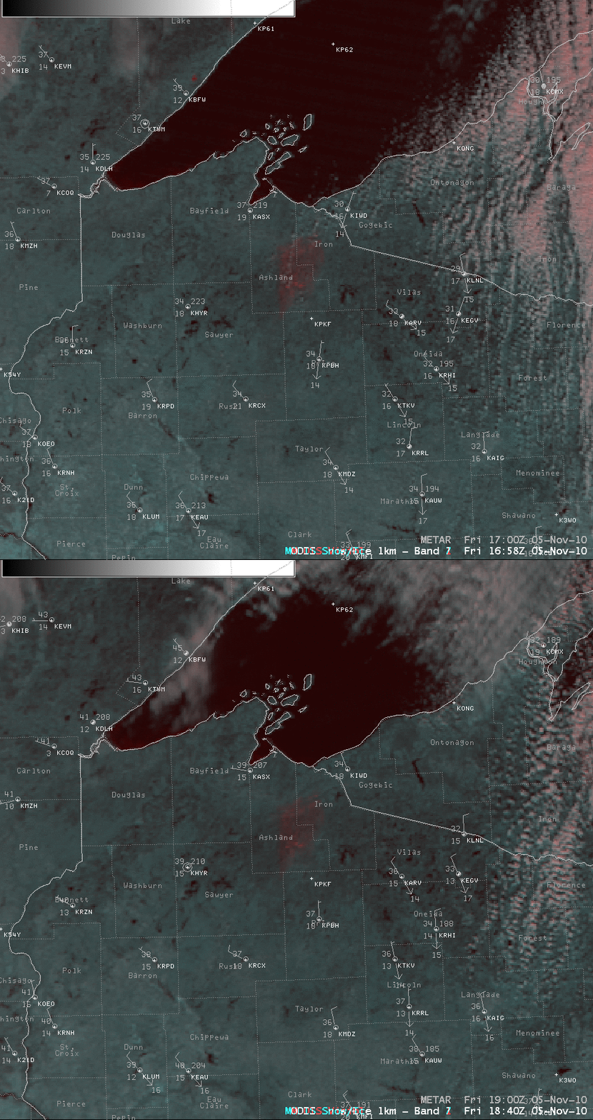
AWIPS images showing another set of MODIS false color RGB images (below, created using Bands 1/7/7) showed that the patch of snow cover — which appeared as a red-colored feature in these particular RGB images — remained stationary between the times of the Terra satellite overpass (around 16:58 UTC, or 11:58 am local time) and the Aqua satellite overpass (around 18:40 UTC, or 1:40 pm local time), which again confirmed that this was snow cover rather than a cloud feature. Upson in Iron county had received 3 inches of snow during the preceding 48 hours, with Butternut in Ashland county receiving 1.0 inch of snowfall.


