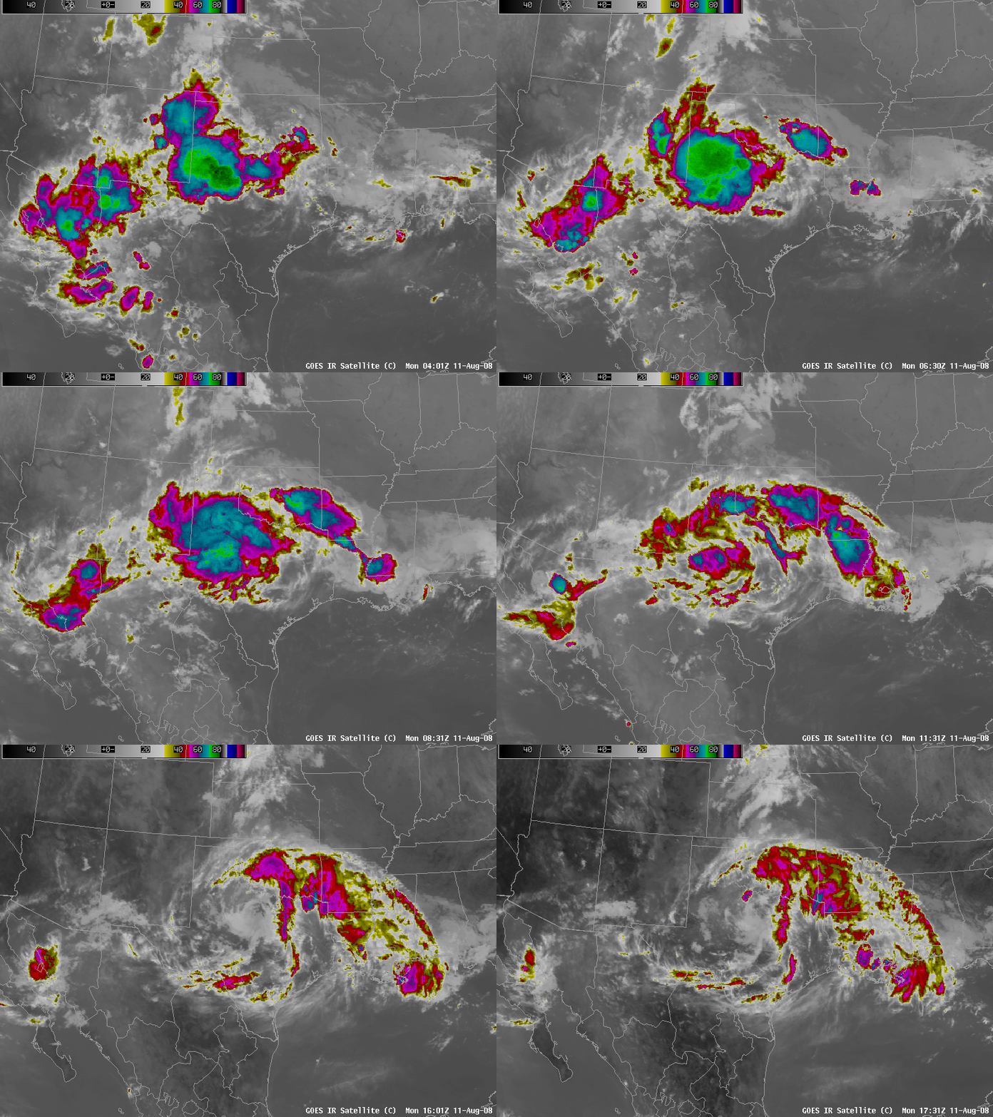
MCV over Texas
Mesoscale Convective Vortices (MCVs) will occasionally emerge from under the eroding cirrus canopy of a Mesoscale Convective System (MCS). Typically, an MCS will dissipate shortly after sunrise, but in atmospheres that include plentiful moisture and little vertical wind shear, the MCV that very frequently develops in an MCS can persist and serve to force subsequent convective development. (Previous MCVs have been documented in the CIMSS Satellite Blog here, here and here).
Strong convection that developed over western Texas early in the morning on Monday 11 August grew into a MCS that quickly eroded near sunrise. However, a swirl of mid-level clouds in the IR image loop above, and in the visible loop here, clearly show the persistence of an MCV. Note in the visible loop how subsequent convection develops very near the propagating MCV, first just to the northwest of the vortex (with the convection spreading south) and then to the north and east.
An MCV is driven mostly by the release of latent heat in convective clouds. Such heating will alter the stability and thus force the development of a vortex. The persistence of the vortex is a balance between the effects of ongoing convection releasing latent heat (maintaining the vortex) and the effects of strong vertical wind shear that serves to weaken the vortex. On this day, a rich moisture source is evident, as noted in the plot here of surface (yellow, in degrees Fahrenheit) and 850-mb dewpoints (white, in degrees Celsius). In addition, GFS model output of 850-500mb shear at 1200 UTC and 1800 UTC show minimal values in Texas where the MCV persisted.
Because forcing associated with the MCV can aid subsequent convective development, noting their presence — an easy task in satellite animation — is vital.


