Lake Effect Now Active Over Great Lakes
In a sign that the seasons are changing, the lake effect is now clearly visible over the Great Lakes. While most commonly associated with heavy snowfalls downwind of the Great Lakes, in these early pre-freezing times of the year it can be associated with the enhancement of rainfall as well. The lake effect has two principal causes: colder air that originated over land is advected over warmer lake water causing latent heat transfer into the cold air mass, while the topographical lift and sudden increase in friction at the opposite shore forces additional upward motion, leading to precipitation enhancement. Lake effect clouds are generally shallow compared to more synoptically-forced precipitation systems.
The lake effect is easily detectable via satellite as parallel bands of clouds oriented along the direction of the wind flow. However, advanced tools allow us to gain some additional insight about the lake effect and its underlying processes from satellites. For example, here is the Day Cloud Phase Distinction RGB from GOES-19. In this product, three GOES ABI channels with various cloud microphysical characteristics are assigned the red, green, or blue color in the animation to help highlight various characteristics of the clouds. In this product, low level liquid-phase clouds are lavender or cyan, thicker liquid clouds are yellow, glaciating clouds are green, and thin cirrus are salmon.
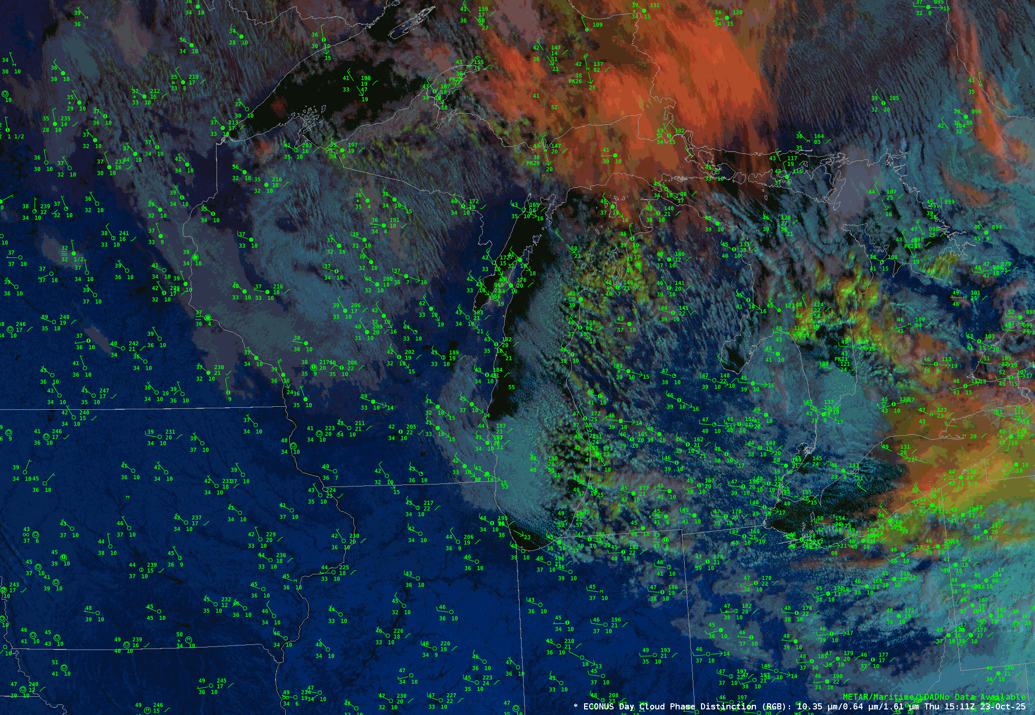
To begin with, the ASOS observations plotted on the above animation show northeasterly winds on either side of the Lake Michigan shore, being driven by a large midlatitude cyclone centered over northern Quebec (see the surface map here to know more about the synoptic situation). Bands of shallow convection are visible from the central axis of Lake Michigan streaming to the southeast. These clouds are a light cyan to periwinkle in color in this RGB, which indicates that they are likely low-level liquid clouds. This is consistent with what we’d expect for lake effect precipitaiton, especially in mid-October.
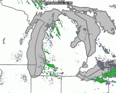
As the clouds propagate toward the Michigan shore, they become more congested and are changing to a greenish-yellow. This color shift indicates that they clouds are deepening and changing phase to ice at their tops. In fact, these clouds are growing deep enough to precipitate. Since surface temperatures on the western edge of the lower peninsula of Michigan are well into the mid 40s, this takes the form of rain. A contemporaneous view of the NEXRAD radar mosaic is seen below.
Of course, the key factor in the development of lake effect precipitation is a difference in the temperature of the air that originated over the land relative to the temperature of the water surface. The Great Lakes Surface Enivronmental Analysis produced by our colleagues at NOAA’s Great Lakes Environmental Research Laboratory shows that mid-lake temperatures are in the low-to-mid 60s.

However, the surface temperatures over Wisconsin depicted in the initial animation show that the airmass likely has a temperature in the mid 40s. That is a substantial difference between the lake and the air that is advecting over it, and so it should not be a surprise that this is having an impact on the precipitation patterns.
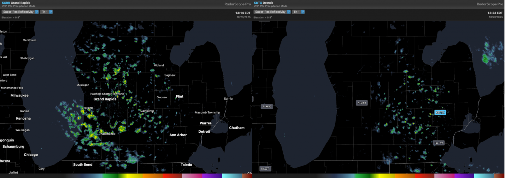
As noted above, lake effect precipitation is shallow. One way to illustrate this is by looking at two adjacent radars. The minimum elevation angle for a NEXRAD weather radar is typically set to 0.5 degrees above the horizon while the surface of the earth is curving away from the beam. This means the further away from a radar one goes, the farther above the surface the bottommost radar beam is. While deep precipitation systems are tall enough to be easily visible from multiple radars, shallow systems can often sneak below the minimum beam height. Here, contemporaneous radar images from Grand Rapids, Michigan(left), and Detroit (right), are shown. Note how the Detroit radar is unable to detect the rain in the western half of the state: it’s just too shallow to appear on that radar.
The lake effect will likely be contributing to rain and snow over the next few months as the large thermal mass of the lake generally means it remains warmer than the surrounding land for much of the fall and winter. (In the spring, the temperature gradient reverses and lake breezes are born instead).