Persistent fog and stratus over southern California
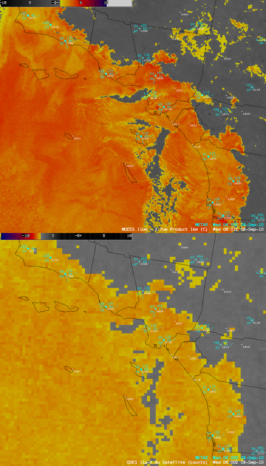
AWIPS images of the 1-km resolution MODIS fog/stratus product and the 4-km resolution GOES-11 fog/stratus product (above) revealed the presence of fog and stratus clouds that extended fairly far inland across much of southern California around 06 UTC on 08 September 2010 (11 pm local time on 07 September). The improvement in spatial resolution on the MODIS image allowed a more accurate assessment of the location of the stratus cloud edges, as well as the location of the cloud holes immediately offshore.
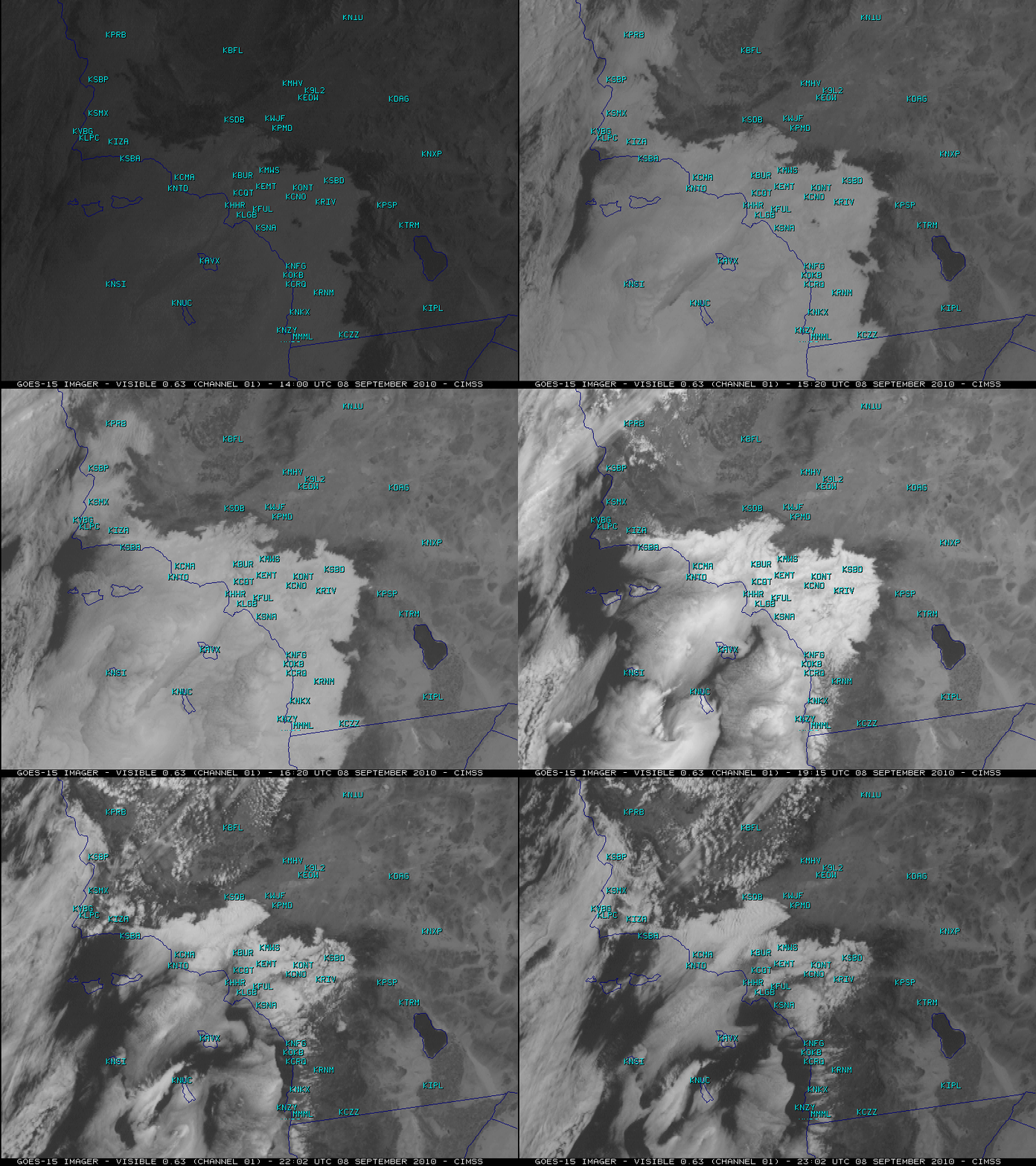
McIDAS images of the GOES-15 0.63 µm visible channel data (below) showed how persistent this deck of stratus clouds was during the daytime hours. In fact, these clouds held down temperatures such that the daily high temperature was only 68º F at Burbank (station identifier KBUR, located near the center of the images) — their normal high temperature for the date is 88º F, and they had a high temperature of 102º F just 4 days earlier.
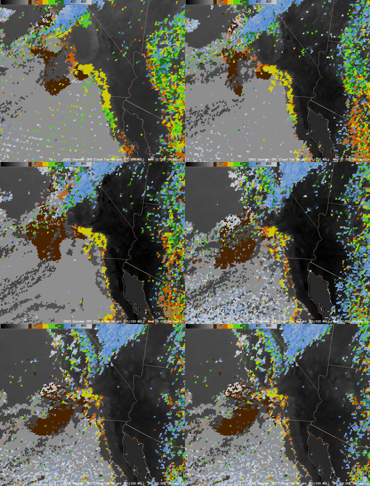
10-km resolution GOES-11 sounder Cloud Top Height product images (below) showed that there was a high amount of variability in the heights of these stratus cloud tops (which was also evident in the appearance of the stratus cloud deck on the GOES-15 visible imagery above).


