Convective cloud top properties: temperature and ice particle size
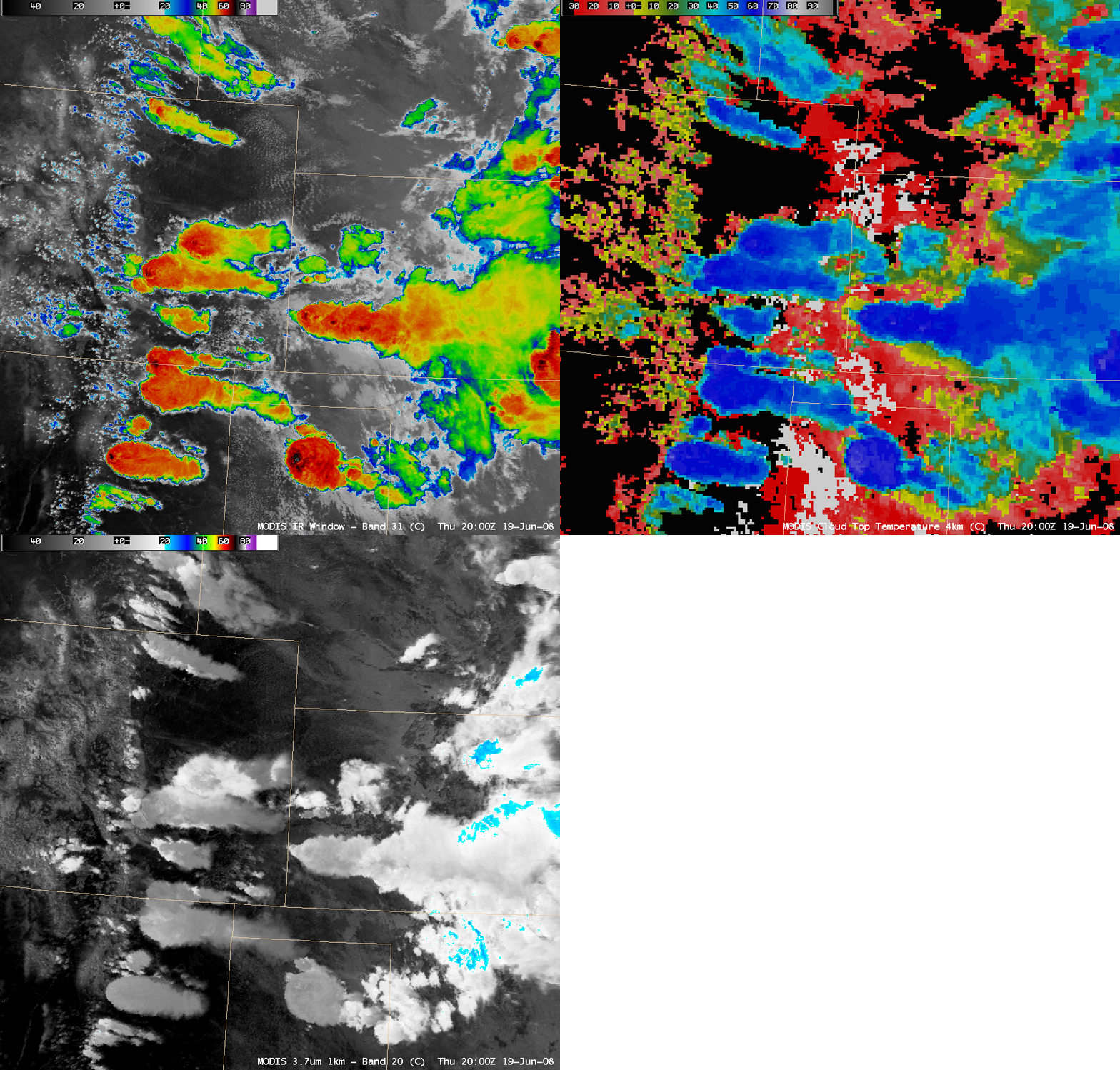
Numerous severe thunderstorms developed along the foothills of the Rockies and the High Plains during the afternoon hours on 19 June 2008. AWIPS images of the MODIS 11.0 µm “IR window” channel, Cloud Top Temperature product, and 3.7 µm “shortwave IR” channel (above) showed some of these areas of convection around 20:00 UTC (2 PM local time). Shortly after the time of these MODIS images, hail up to 2.75 inches in diameter was reported near Pueblo, Colorado (SPC storm reports). About 90 minutes after the time of the MODIS images, hail of 4.50 inches in diameter and a wind gust to 81 mph was produced by the storm that was seen developing in the Texas panhandle region. Although these storms exhibited similar cold cloud top temperatures on the IR window image (-60 to -77º C, red to black to gray color enhancement) and the Cloud Top Temperature product (-60 to -69º C, darker blue to light violet color enhancement), note the darker gray appearance of many of the westernmost storms on the 3.7 µm shortwave IR image — this darker signal is due to a dominance of smaller anvil top ice particles (in contrast with the brighter white appearance due to larger anvil top ice particles associated with the storms farther to the east). Anvils composed of smaller ice particles are more reflective of incident solar radiation, which results in significantly warmer shortwave IR brightness temperatures (in this case, +5 to +20º C, compared to -10 to -15º C in the brighter white anvil features composed of larger ice particles). According to Lindsey et al. (2006), regions such as the high plains and mountains (having environments with relatively dry boundary layers, steep lapse rates, and large vertical shear values) tend to favor thunderstorms with enhanced 3.9-μm reflectivity.
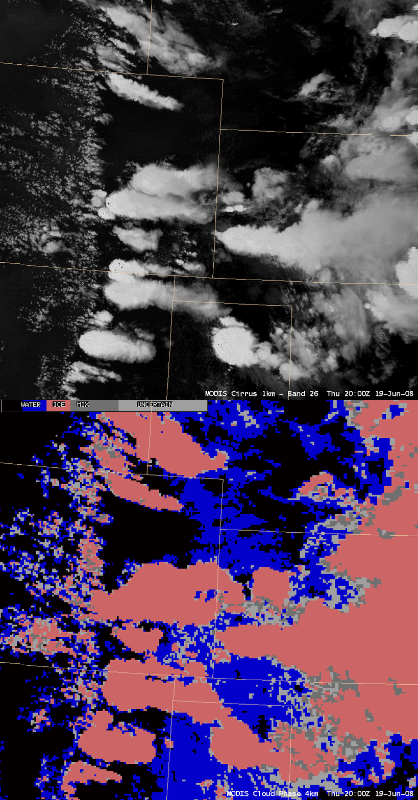
With cloud top temperatures in the -60 to -70º C range, no supercooled water droplets could have been present at the cirrus anvil top — this was confirmed by the MODIS “cirrus detection channel” image in tandem with the MODIS Cloud Phase product (below), which indicated ice phase (salmon color enhancement) for all the convective storm cirrus anvil features.
Additional reference:
 Cloud-top Structure of Northeast Colorado Thunderstorms May 24, 2005


