Blowing dust plume in eastern Idaho
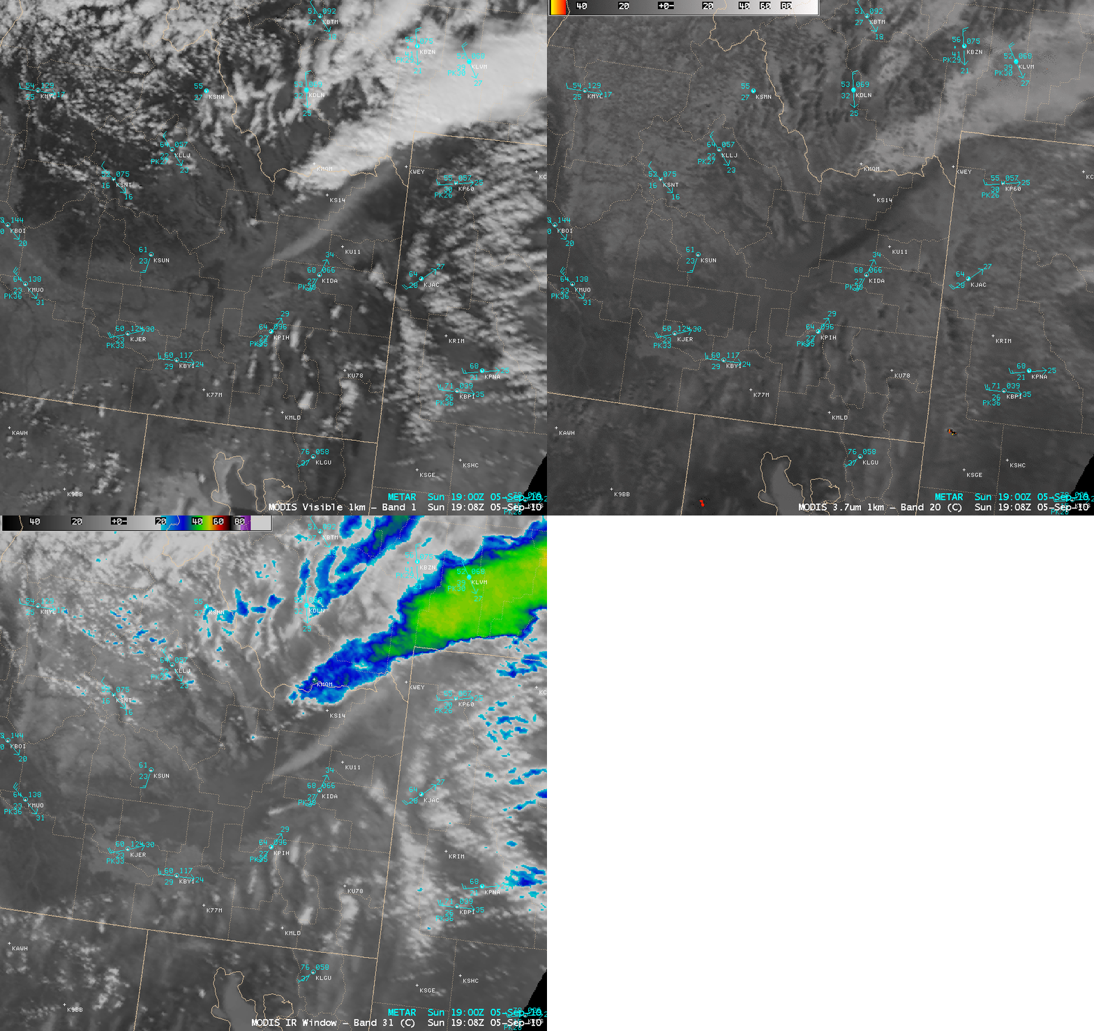
Winds gusting in excess of 50 mph across parts of eastern Idaho on 05 September 2010 created a plume of blowing dust which could be seen on AWIPS images of the MODIS 0.65 µm visible channel, the MODIS 3.7 µm shortwave IR channel, and the MODIS 11.0 µm IR channel data (above). The blowing dust plume appeared as a slightly brighter, hazy-looking feature on the MODIS visible image, but showed up as a darker feature on the MODIS shortwave IR image due to solar reflection off the small dust particles. There were also no extremely hot pixels (yellow to orange color enhancement) seen at the point source of the plume, ruling out the likelihood that this was smoke from a fire. On the IR image, the dust plume was about 10-15º C colder (lighter gray enhancement) than the surrounding warm land surfaces.
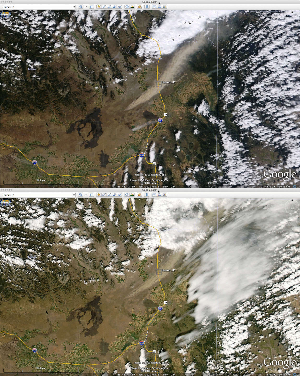
The blowing dust plume was even more apparent on 250-meter resolution Terra and Aqua MODIS true color Red/Green/Blue (RGB) images from the SSEC MODIS Today site (above), displayed using Google Earth. The tan color of the dust plume made it easy to distinguish from the brighter white meteorological clouds in the area. This blowing dust restricted visibility to less than 1/3 of a mile along Interstate 15 near Hamer, Idaho (Local Storm Report).


