Cirrus over the western Great Lakes
From the mailbag early on Friday 9 May 2025
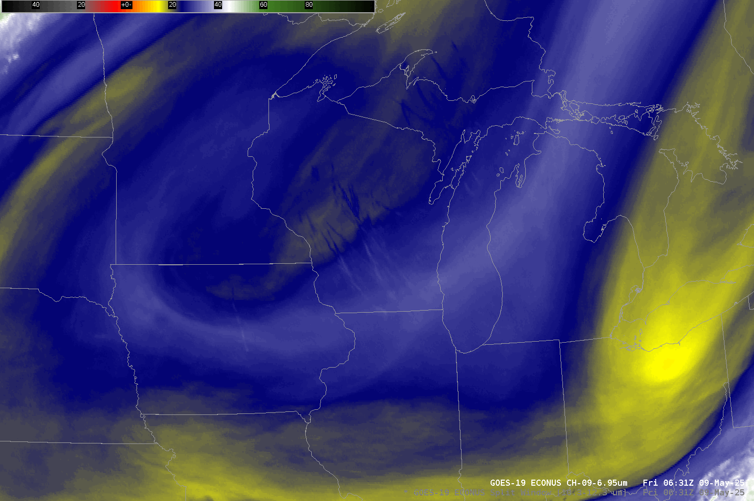
The contrail show over the Lake MI region is pretty crazy this morning with the rotated flow aloft. Wondering if these are originating from a bunch of intercontinental flights that touch high latitudes in "great circle" fashion.What did the mid-level water vapor imagery show? The 10-hour animation below from 0636 to 1631 UTC does indeed show multiple contrails, colder than their surroundings, rotating around an upper-level anticyclone over Iowa/Minnesota. (Click here for a view from the ground).
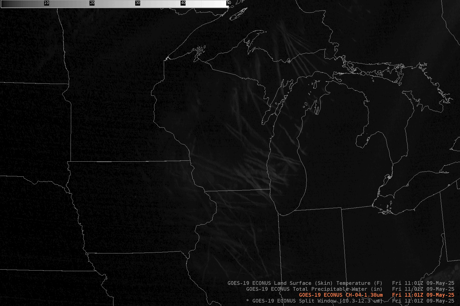
What other GOES-R bands/products allow one to view cirrus clouds? ABI’s Band 4 detects radiation at 1.38 µm, a radiation wavelength that is strongly absorbed by water vapor. Thus, in regions of water vapor, any reflective signal is strongly attenuated if there is water vapor above the reflective surface. Contrails high in the atmosphere typically are not overlain by much water vapor, so Band 4 will highlight these features during the daytime. The signal from any low-level cloud, however, is attenuated by water vapor in the atmosphere.
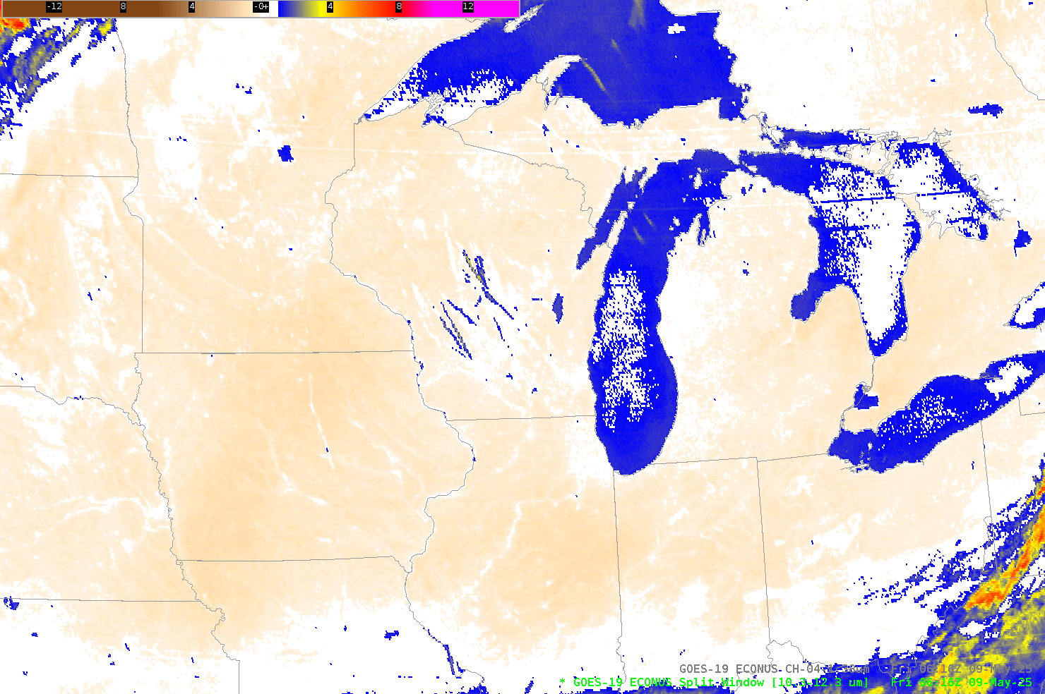
The Split Window Difference (SWD) fields, 10.3 µm – 12.3 µm, can also be used to detect the presence of cirrus clouds. Contrails show positive SWD values because of stronger absorption by water vapor of radiation with wavelengths of 12.3 µm than at 10.3 µm. The sub-pixel effect is also important. The satellite sensor at 12.3 µm is more sensitive to the colder part of the pixel in a partly cloudy scene that includes contrails that will not cover the entire satellite pixel. The 10.3 µm sensor will be a bit more sensitive to the warmer parts of the pixel than the 12.3 µm sensor. The difference field will therefore highlight contrails.
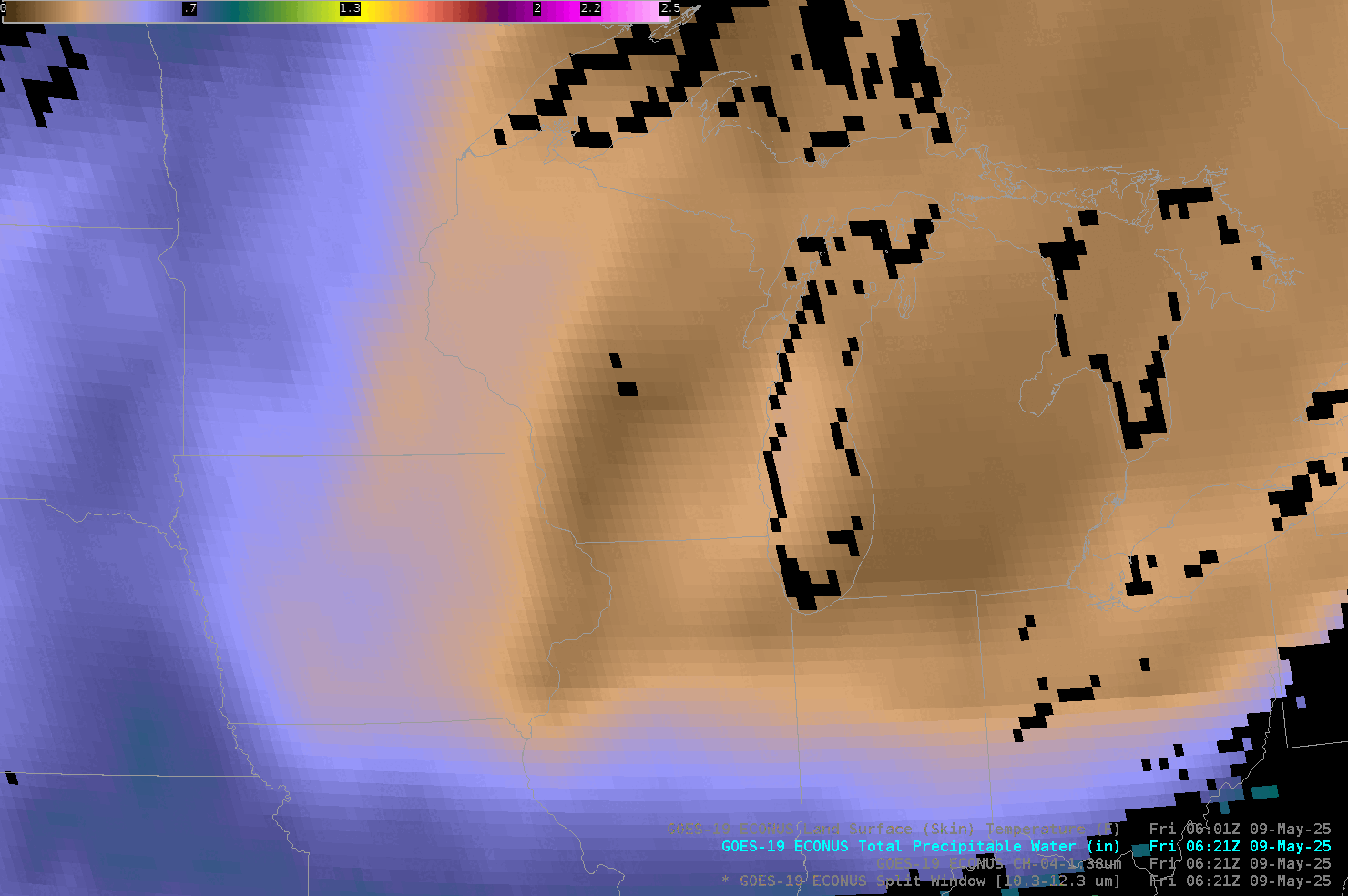
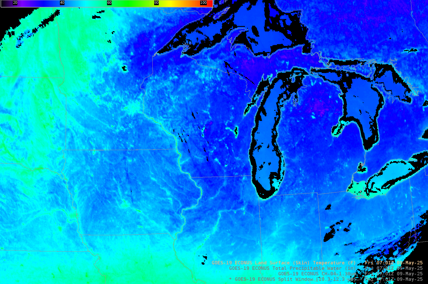
The Split Window Difference value shown above changes as the sun comes up and the boundary layer warms. Eventually, the gradient in Total Precipitable Water (TPW) that is evident in the animation below, also becomes apparent in the animation above. A strong inversion as was present on this day (here is the Quad Cities IA sounding, and here is the Chanhassen MN sounding). Once the inversion breaks, the SWD signal that describes moisture becomes more apparent. The hourly Land Surface Temperature estimates that might be used to detemined when the inversion is breaking are shown at the bottom.
This 2014 journal article by Lindsey et al. describes in more depth the evolution of SWD values as the boundary layer warms. Thanks to TJ Turnage, SOO in Grand Rapids, for the email!