Long-range transport of blowing dust from Mexico, New Mexico and Texas to the Upper Midwest

5-minute GOES-19 daytime True Color RGB + nighttime Dust RGB images, from 1901 UTC on 27 April to 0601 UTC on 28 April [click to play animated GIF | MP4]
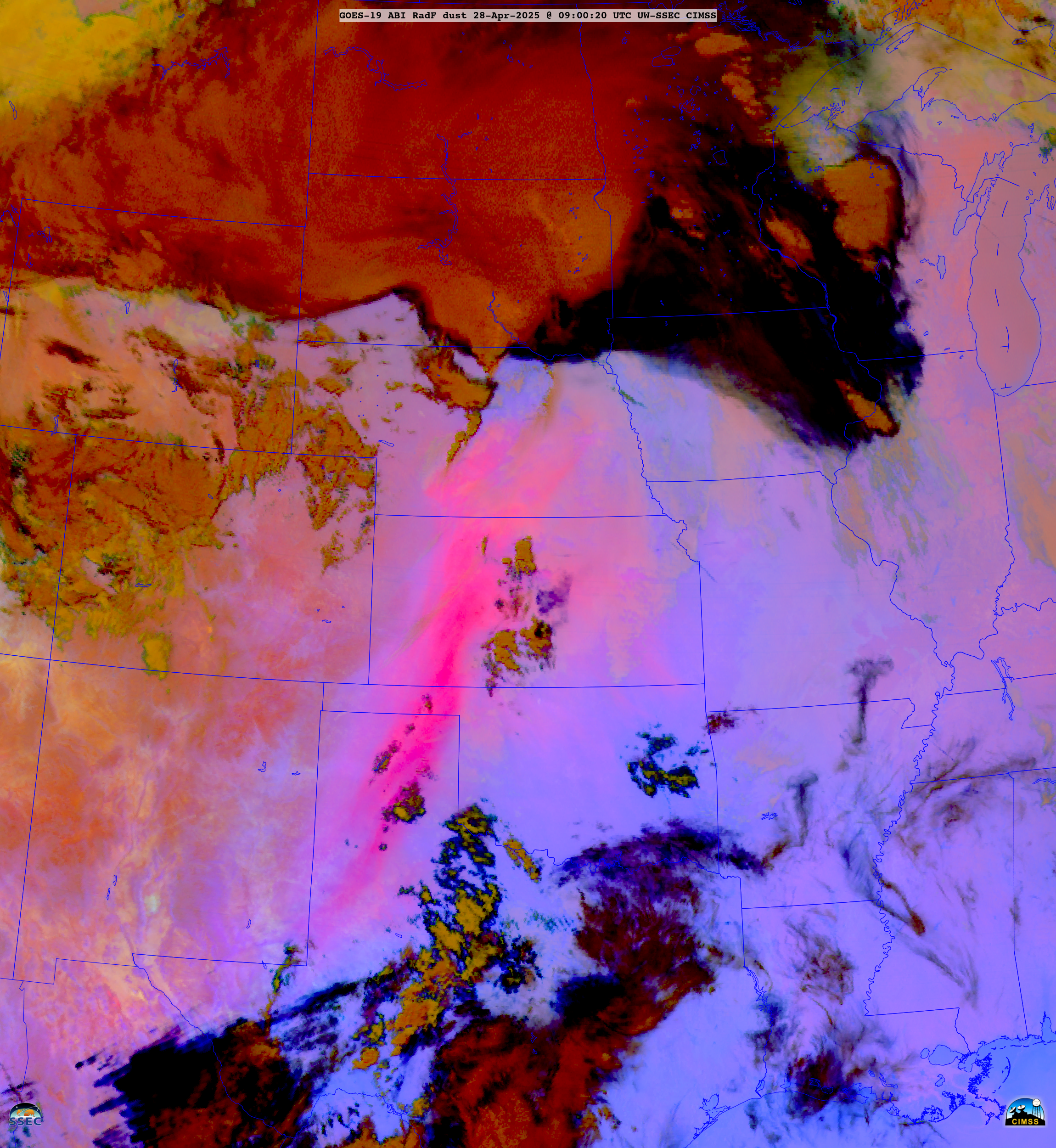
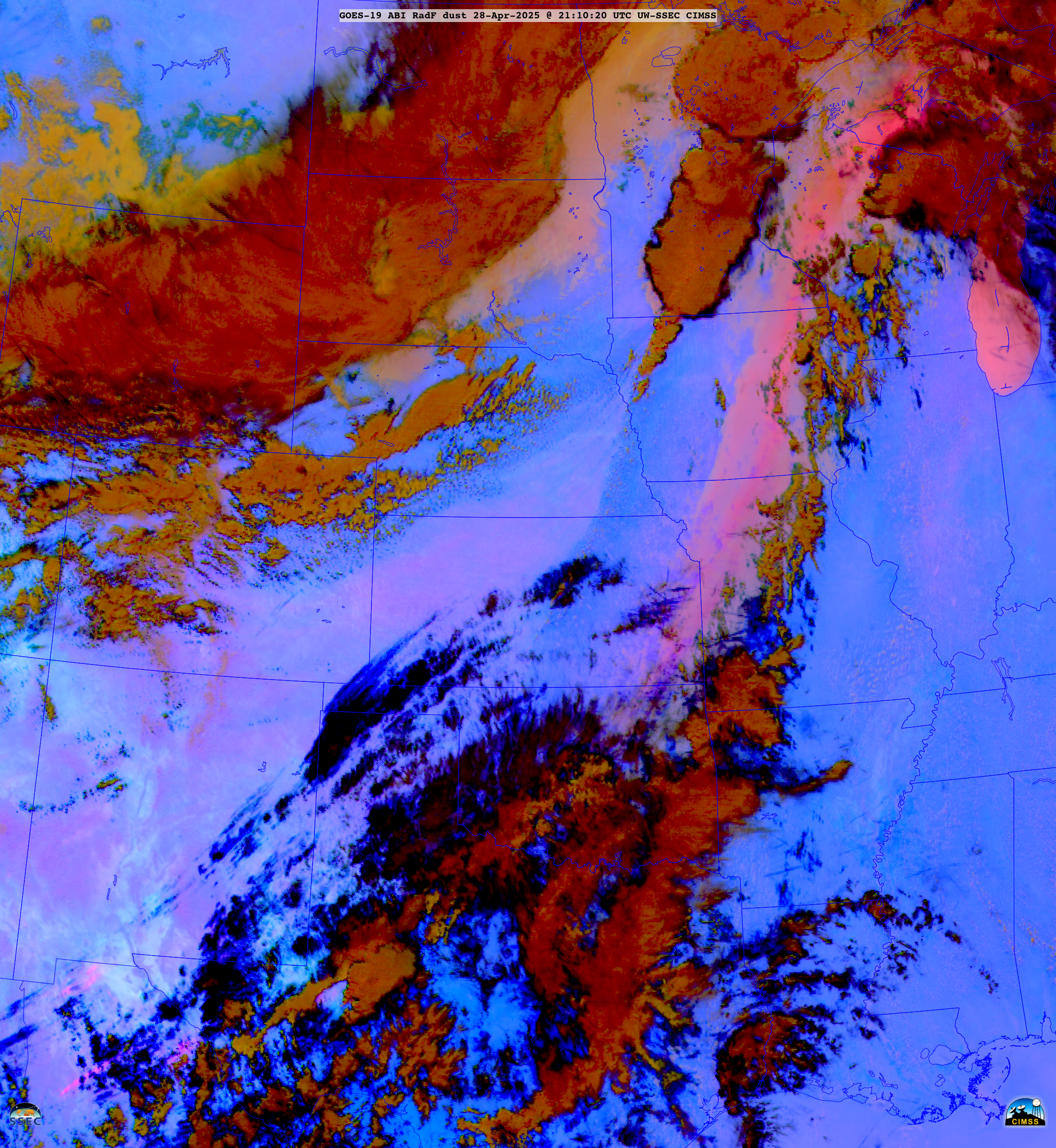
A longer animation of 10-minute Full Disk scan GOES-19 Dust RGB images (below) showed that the leading edge of airborne dust had advanced as far northeastward as Nebraska by 0900 UTC on 28 April, and northwestern Wisconsin and the western Upper Peninsula of Michigan by 2110 UTC on 28 April.

10-minute GOES-19 Dust RGB images, from 1800 UTC on 27 April to 0600 UTC on 29 April [click to play animated GIF | MP4]
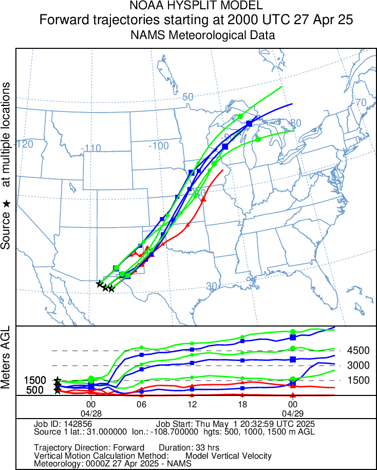
HYSPLIT Model forward trajectories, from 2000 UTC on 27 April to 0500 UTC on 29 April